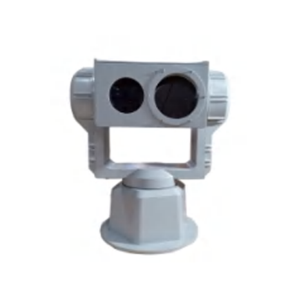
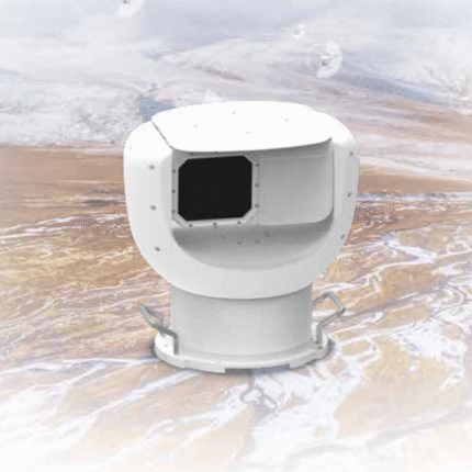
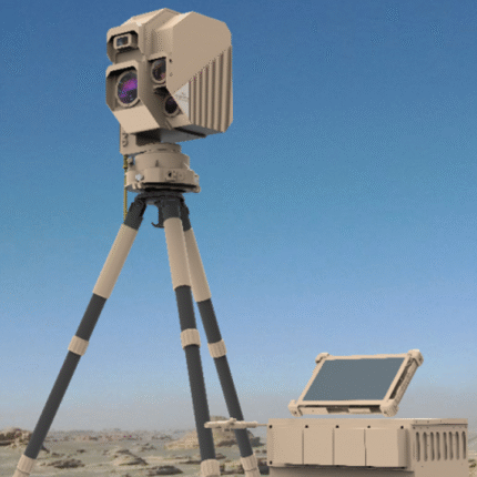
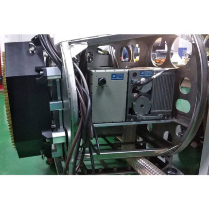
Welcome To China Moneypro Official Website
Menu
Search
Browse Categories
  • UAV/Drones
  • Airplane & VTOL
  • EO/IR Gimbal & Payload
  • Smart Robots & Cars
  • UAV Accessories
  • Anti Jamming & GNSS Antennas
  • Infrared Thermal & laser Sensing
  • Integrated Anti-Drone System
  • Data Radio & Image Link
  • UAV RC & Ground Station
  • Flight Controller & GPS & RTK
  • Battery & Charger
  • Home
  • Product
    • UAV/Drones
      • Agricultural Drone
      • Multi-rotor UAV
      • Single-rotor UAV
      • Fiber Optic FPV Drone System
      • Multifunctional Drone
    • Airplane & VTOL
      • Petrol Electric Hybrid VTOL
      • Composite Wing Flight Platform
      • Tethered Drones
      • Tether Box
      • VTOL Fixed Wing UAV System
    • EO/IR Gimbal & Payload
      • Inspection & Filming Camera
      • Mapping & Surveying Camera
      • Package Delivery System
      • Security Camera
    • Smart Robots & Cars
      • Robotic Unmanned Ground Vehicle (UGV)
      • Unmanned Surface Vehicle USV
    • UAV Accessories
      • Propulsion System
      • Battery & Charger
      • Flight Controller & GPS & RTK
      • UAV RC & Ground Station
      • Turbojet Engine Systems
      • Drone Hangar
      • Inertial Navigation MEMS/IMU/Gyroscopes
      • Atmospheric Treatment
      • Data Communication
      • Partsassembly
      • Radar Detection
      • Scene Simulation
      • Drone Engine
    • Anti Jamming & GNSS Antennas
      • RTK GNSS Receiver
      • GNSS Module
      • Digital Communication Modules
      • Anti Jamming Sensor
      • GNSS Antenna
      • GNSS Receiver
      • RTK GNSS Antenna
      • RTK GNSS Board
      • Anti Jamming Antenna
    • Infrared Thermal & laser Sensing
      • Infrared Photoelectric imaging Solutions
      • Thermal Module
      • Laser Rangefinder
      • Thermal Imaging Binocular/ Monocular/ Variable Optic/ Observer
    • Integrated Anti-Drone System
      • Surveillance Rada Systems
    • Data Radio & Image Link
      • Wireless Networks Mesh Radio Systems
      • UAV Data link/Video transmission
      • UAV Ground Base Station
      • Robot Video and Data Transceiver Radio
      • Wireless Data Transceiver Radio
      • RF Module
      • OEM Customized
  • Products Capabilities
    • Agriculture Drone
    • Industrial Drone
    • Military and Police Drones
    • Specialized Drones
    • Underwater Drones
    • Educational/Entertainment Drones
    • EO/IR Gimbal camera payload
    • GPS RTK / GNSS Antenna Modules
    • Infrared Thermal & Laser Sensing systems
    • Radar Systems
    • Turbo Engines
    • Wireless Broadband Mesh Network Radio
  • Solution
  • About Us
    • Support
    • Video
    • Export Compliance Statement
  • News
  • FAQ
    • About Drones/UAV
    • About Gimbal Camera Payload
    • About Infrared Thermal Imaging Equipment
    • About Onboard Active Phased Array Radar
    • About Long-range Network Mesh Radio
    • About Anti-Jamming Antennas
    • About Integrated Anti-Drone Systems
    • About GNSS-antennas
    • About Turbojet Engines
  • Contact us
Click to enlarge
Home » Unmanned System Products » China Moneypro MPS196 Next-Generation SAR Reconnaissance Synthetic Aperture Radar Payload Systems
China Moneypro MT360B GNSS Antenna
Back to products
China Moneypro MPY136 airborne Multi-Function Active Phased Array Fire-Control Radar (AMFCR)

China Moneypro MPS196 Next-Generation SAR Reconnaissance Synthetic Aperture Radar Payload Systems

At China MoneyPro, we specialize in the custom design and development of Synthetic Aperture Radar (SAR) systems, delivering solutions that represent the cutting edge of global radar technology. Our mission is to help clients achieve unmatched imaging, detection, and reconnaissance performance under the most challenging

Categories: Integrated Anti-Drone System, Surveillance Rada Systems
Share:
  • Description
Description

Product Overview

China Moneypro MPS196 SAR (Synthetic Aperture Radar) Reconnaissance Payload is an advanced active microwave remote sensing system that enables all-weather, day-and-night imaging capabilities. With the ability to penetrate clouds, fog, and partial surface coverings, it provides unparalleled situational awareness across both military and civilian applications.

  • Military Applications: strategic and tactical reconnaissance, target identification, battlefield assessment, missile guidance, moving target indication (MTI), and maritime surveillance.
  • Civilian Applications: disaster monitoring, natural resource exploration, precision agriculture, forestry management, and infrastructure inspection.


Key Features

  1. Anti-Jamming Performance– Strong resistance to co-frequency interference and suppression jamming.
  2. Dual-Sided Imaging– Real-time stripmap imaging of stationary or slow-moving ground targets.
  3. Spotlight Mode– Real-time high-resolution imaging of designated regions.
  4. Command & Control Functions– Remote self-check, servo loop inspection, power management, and mode switching.
  5. Built-in Reliability– Power-on self-test, real-time fault monitoring, and fault localization.
  6. Flexible Maintenance– Support for non-intrusive testing and software online upgrade.
  7. Stabilized Operation– Space stabilization under platform motion.
  8. Comprehensive Data Logging– Raw echo data and system status recording with detachable storage or easy download capability.


Technical Specifications

Antenna & Servo System

  • Scan Range: Azimuth –110° to +110°, Elevation –5° to –45°
  • Pointing Accuracy (3σ): Azimuth ≤ 0.1°, Elevation ≤ 0.2°

SAR Imaging

  • Operating Band: Ku-band
  • Imaging Range: Azimuth ±70°–110°, Elevation –3° to –45°
  • Resolution & Coverage: Optimized across multiple pixel resolutions, with performance not inferior to specified benchmarks

Imaging Performance Requirements (Typical Ground Height H = 2000 m)

  • Ground Resolution: 0.5 m × 0.5 m
    • Operating Range: 8 km
    • Imaging Swath: ≥ 4 km
    • Reference Index Swath: ≥ 5 km
  • Ground Resolution: 0.3 m × 0.3 m
    • Operating Range: 6 km
    • Imaging Swath: ≥ 2 km
    • Reference Index Swath: ≥ 3 km
  • Ground Resolution: 0.1 m × 0.1 m
    • Operating Range: 3 km
    • Imaging Swath: ≥ 1 km
    • Notes: Reference Index
  • Noise Equivalent Sigma Zero (NEδ0): ≤ –20 dB
  • Real-Time Imaging: <10 s processing, with no accumulation required for echo data
  • Geolocation Accuracy: ≤10 m CEP in flat terrain
  • Typical Scenes: desert, urban areas, farmland, ports, airports, coastal regions
  • Image Distortion (3σ): ≤2.5% in ground projection direction
  • Gray Scale Quantization: 8-bit
  • Continuous Imaging Duration: ≥15 minutes

Data Storage & Transmission

  • Storage Capacity: ≥1 TB
  • Data Interface: Gigabit Ethernet or other high-speed interfaces for ground station connectivity

Mechanical & Physical

  • Dimensions: 190 mm (W) × 155 mm (H) × 250 mm (L)
  • Weight: ≤7 kg

Advantages at a Glance

  • All-weather capability: Reliable imaging in rain, fog, and low-visibility conditions.
  • High precision: Sub-10 m geolocation accuracy.
  • Compact & Lightweight: Less than 7 kg with small form factor, ideal for UAV and airborne integration.
  • High endurance: Continuous imaging up to 15 minutes with fast data processing.


Why Partner With Us?

  • Tailored Solutions– We work closely with clients to develop SAR systems optimized for their unique mission profiles, whether airborne, naval, or ground-based.
  • Next-Generation Technology– Leveraging Ku-band and multi-band architectures, ultra-wideband waveforms, and adaptive digital beamforming, our systems deliver sub-meter resolution and real-time imaging refresh rates exceeding international benchmarks.
  • Advanced Anti-Jamming & Anti-Spoofing– Built-in electronic counter-countermeasures (ECCM), space-time adaptive processing (STAP), and AI-driven interference suppression ensure mission success in highly contested electromagnetic environments.
  • Lightweight & Compact Design– Proprietary materials and miniaturized RF components enable payloads weighing under 10 kg, seamlessly integrating with UAVs, aircraft, and mobile platforms.
  • Data Intelligence Ready– SAR outputs are optimized for fusion with AI analytics, EO/IR imaging, and IMU/GNSS navigation, enabling next-generation situational awareness and decision-making.


Download china-moneypro-mps196-next-generation-sar-reconnaissance-synthetic-aperture-radar-payload-systems-datasheet


The SAR Reconnaissance Payload is a compact, lightweight, and high-performance solution designed for next-generation ISR (Intelligence, Surveillance, and Reconnaissance) missions. With its Ku-band high-resolution imaging, advanced anti-jamming capability, and versatile integration features, it stands out as a reliable choice for both defense and civilian applications.

📩 Learn More & Contact Us

For more details, datasheets, and integration support, please visit our website or contact our sales team.

🌐 Website: www.moneyprouav.com
✉️ Email: sales@moneyprouav.com
📞 Phone: +86-18126437260  (Wechat Telegram What’s App)

Related products

China Moneypro Drone Signal Detection And Simulation Devices SMA J1-1500

Boost anti-drone operations with the SMA J1-1500—a hand-held signal simulator offering 1.5km range, multi-channel interference, and rapid response for security, defense, and UAV testing applications.

China Moneypro MPY136 airborne Multi-Function Active Phased Array Fire-Control Radar (AMFCR)

The Airborne Multi-Function Fire-Control Radar (AMFCR) is a state-of-the-art, multi-role active electronically scanned array (AESA) radar system, engineered for air superiority, precision strike, maritime surveillance, and advanced navigation support. Designed for next-generation fighter aircraft, UAVs, and special mission platforms, it combines long-range detection, high-resolution imaging, and multi-target engagement into one compact, fully digital solution.

China Moneypro M12 Series – 360° Infrared Panoramic Radar

China Moneypro M12 series is a passive electro-optical radar designed for 360° panoramic surveillance. Using an industry-leading 12 μm infrared detector with a resolution of 1280×1024, it delivers high-clarity, long-range imaging and real-time panoramic video. Capable of simultaneously tracking up to 128 targets within an 8 km detection radius, it ensures accurate monitoring of personnel, vehicles, ships, and UAVs in all-weather conditions. This system is ideal for border defense, coastal security, oil and gas fields, key infrastructure protection, and nature reserves, providing a comprehensive all-round security solution.

China Moneypro Drone Signal Detection And Simulation Devices SMA J6-2000

The SMA J6-2000 combines real-time RF detection input with auto-targeting jamming to force drones into hover, landing, or return-to-home modes. Ideal for high-security zones requiring immediate response.

MZL20 series anti-drone laser strike system

The ZL20 features modular, lightweight, and standardized design, enabling both mobile platform deployment and permanent fixed installations. Capable of detecting various small drones like DJI Phantom 4 and FPV through autonomous search or radar guidance modes, it delivers rapid, accurate detection with zero collateral damage, serving as an effective solution to prevent unauthorized flights and accidents involving "low-altitude, slow-moving, small-sized" targets. The equipment boasts easy disassembly, portability, reliability, strong environmental adaptability, and multi-network capability, making it widely applicable in core departments, airports, oil depots, grain warehouses, nuclear power plants, dams, refineries, and large-scale event venues for low-altitude security defense needs.

T18 active phased array radar

The T18 is a lightweight and portable short-range defense frequency-modulated continuous wave active phased array radar. It employs DBF digital beamforming and simultaneous multi-beam technology; capable of detecting target movement speeds of 1-180 m/s; elevation angle range of -5 to 60°; angular accuracy of 0.4° and range accuracy of 5 m; data refresh rates of 1s/2s/3s; can simultaneously and stably track over 300 targets; scanning coverage includes an area with altitude ≥2000 m and radius ≥15 km; with a portable turntable, the entire system has a power consumption ≤350 W, and the radar's total weight is <30 kg; for micro DJI mini-series drones, it supports a detection range of ≥5 km; with a transmission power of only ≤30 W, it offers extremely high operator safety and urban environment compatibility; on the battlefield, due to its minimal transmission power, it has an extremely low probability of interception, significantly enhancing battlefield survivability.

T10 high precision three coordinate active phased array radar

The T10 Tri-Coordinate Active Phased Array Radar System employs a DBF Digital Beamforming architecture with simultaneous multi-beam technology, delivering exceptional detection sensitivity and superior anti-jamming capabilities. It achieves over 5km detection range for DJI Phantom 4 and Yi3Pro drones (RCS=0.01㎡) (with a measured maximum of 8km), while maintaining an 8km detection range against ground infantry (RCS=0.5㎡). With a scanning radius of 10km and coverage exceeding 1000 meters, the system provides high-precision target acquisition and trajectory tracking capabilities. The T10 radar boasts robust data processing capabilities, perfectly adapted to complex near-Earth ultra-low-altitude operational environments. It can distinguish micro-drone targets like the DJI Mini 3 Pro (249g) from intricate background clutter while maintaining stable tracking performance. Powered by a high-performance computing architecture, the T-series 3D radar supports a 1S data refresh rate, enabling rapid target acquisition and radar guidance to seize fleeting battlefield opportunities. The T10 radar is a low-interception-rate system designed for battlefield applications. Its transmission power is only one-tenth of conventional pulse radar, with antenna gain reduced by half. At the same range, its power density drops to 1/60-1/40 of standard pulse radar, while the signal interception distance is merely 1/10-1/5 of conventional systems. This configuration grants it superior battlefield survivability. Compared with the same power rival products, T10 tri-coordinate radar has nearly 1/4 of the power consumption (mobile power supply can support), nearly half of the weight (portable emergency) of the rival products, the highest detection accuracy in the industry; the highest data refresh rate in the industry; in terms of anti-jamming interference, it can also reach the highest level in the radar industry. In addition, the T10 radar antenna has built-in satellite navigation and positioning and direction finding self-calibration capability. After unfolding the tripod turntable and installing the radar panel, it can automatically locate and direction find, and then start working after being powered on, accurately reporting the three-dimensional coordinates and motion parameters of the target. Therefore, the T series radar with its light weight, low power consumption, high precision and high speed is particularly suitable for emergency deployment requirements supported by mobile power supply. Two or three soldiers can carry the full set of equipment, and the deployment can be completed within 5 minutes after arriving at the predetermined location and entering the working state.

China Moneypro Drone Signal Detection And Simulation Devices SMA D5-2000

World's lightest (0.5kg) military-grade UAV detector with 3km real-time tracking of drone position, speed, altitude, AND pilot location—100% passive detection with 99% identification accuracy in just 1 second.

CONTACT US

  • +86-755-21004586
    +86-18126437260
  • sales@moneyprouav.com
    moneyprouav@gmail.com
  • Office: East of the 16F, Building B, TCL Industrial Research Institute Building, No. 006, High-tech South Road, Nanshan District, Shenzhen City, China.
    Factory I: Building B , Gualan High-Technology Park, Longhua District, Shenzhen City, Guangdong Province.
    Factory II: Bajia Intelligent Equipment Garden, Boluo, Huizhou, Guangdong Province.
    Factory III: No. 169, Yingshanhong Road, Huangdao District, Qingdao City, Shandong Province.
  • What's App: +1-(213) 613-5938
    Telegram: +1-(213) 613-5938
    Wechat: +86-18126437260    
Product
  • UAV/Drones
    • Drone Hangar
    • Multi-rotor UAV
    • Single-rotor UAV
  • Airplane & VTOL
  • EO/IR Gimbal & Payload
  • Smart Robots & Cars
  • UAV Accessories
  • Anti Jamming & GNSS Antennas
  • Infrared Thermal & laser Sensing
  • Integrated Anti-Drone System
Support
  • Products Spec
  • Documents Download
  • Hardware Software
Video Center
  • UAV Video
  • Gimbal Camera Video
  • Unmanned Robots
About us
  • About Us
  • Contact us
Copyright © 2025 China Moneypro Group Corporation Limited. All Rights Reserved
  • Home
  • Product
    • UAV/Drones
      • Agricultural Drone
      • Multi-rotor UAV
      • Single-rotor UAV
      • Fiber Optic FPV Drone System
      • Multifunctional Drone
    • Airplane & VTOL
      • Petrol Electric Hybrid VTOL
      • Composite Wing Flight Platform
      • Tethered Drones
      • Tether Box
      • VTOL Fixed Wing UAV System
    • EO/IR Gimbal & Payload
      • Inspection & Filming Camera
      • Mapping & Surveying Camera
      • Package Delivery System
      • Security Camera
    • Smart Robots & Cars
      • Robotic Unmanned Ground Vehicle (UGV)
      • Unmanned Surface Vehicle USV
    • UAV Accessories
      • Propulsion System
      • Battery & Charger
      • Flight Controller & GPS & RTK
      • UAV RC & Ground Station
      • Turbojet Engine Systems
      • Drone Hangar
      • Inertial Navigation MEMS/IMU/Gyroscopes
      • Atmospheric Treatment
      • Data Communication
      • Partsassembly
      • Radar Detection
      • Scene Simulation
      • Drone Engine
    • Anti Jamming & GNSS Antennas
      • RTK GNSS Receiver
      • GNSS Module
      • Digital Communication Modules
      • Anti Jamming Sensor
      • GNSS Antenna
      • GNSS Receiver
      • RTK GNSS Antenna
      • RTK GNSS Board
      • Anti Jamming Antenna
    • Infrared Thermal & laser Sensing
      • Infrared Photoelectric imaging Solutions
      • Thermal Module
      • Laser Rangefinder
      • Thermal Imaging Binocular/ Monocular/ Variable Optic/ Observer
    • Integrated Anti-Drone System
      • Surveillance Rada Systems
    • Data Radio & Image Link
      • Wireless Networks Mesh Radio Systems
      • UAV Data link/Video transmission
      • UAV Ground Base Station
      • Robot Video and Data Transceiver Radio
      • Wireless Data Transceiver Radio
      • RF Module
      • OEM Customized
  • Products Capabilities
    • Agriculture Drone
    • Industrial Drone
    • Military and Police Drones
    • Specialized Drones
    • Underwater Drones
    • Educational/Entertainment Drones
    • EO/IR Gimbal camera payload
    • GPS RTK / GNSS Antenna Modules
    • Infrared Thermal & Laser Sensing systems
    • Radar Systems
    • Turbo Engines
    • Wireless Broadband Mesh Network Radio
  • Solution
  • About Us
    • Support
    • Video
    • Export Compliance Statement
  • News
  • FAQ
    • About Drones/UAV
    • About Gimbal Camera Payload
    • About Infrared Thermal Imaging Equipment
    • About Onboard Active Phased Array Radar
    • About Long-range Network Mesh Radio
    • About Anti-Jamming Antennas
    • About Integrated Anti-Drone Systems
    • About GNSS-antennas
    • About Turbojet Engines
  • Contact us

Sending...