Welcome To China Moneypro Official Website
Menu
Search
Browse Categories
  • UAV/Drones
  • Airplane & VTOL
  • EO/IR Gimbal & Payload
  • Smart Robots & Cars
  • UAV Accessories
  • Anti Jamming & GNSS Antennas
  • Infrared Thermal & laser Sensing
  • Integrated Anti-Drone System
  • Data Radio & Image Link
  • UAV RC & Ground Station
  • Flight Controller & GPS & RTK
  • Battery & Charger
  • Home
  • Product
    • UAV/Drones
      • Agricultural Drone
      • Multi-rotor UAV
      • Single-rotor UAV
      • Fiber Optic FPV Drone System
      • Multifunctional Drone
    • Airplane & VTOL
      • Petrol Electric Hybrid VTOL
      • Composite Wing Flight Platform
      • Tethered Drones
      • Tether Box
      • VTOL Fixed Wing UAV System
    • EO/IR Gimbal & Payload
      • Inspection & Filming Camera
      • Mapping & Surveying Camera
      • Package Delivery System
      • Security Camera
    • Smart Robots & Cars
      • Robotic Unmanned Ground Vehicle (UGV)
      • Unmanned Surface Vehicle USV
    • UAV Accessories
      • Propulsion System
      • Battery & Charger
      • Flight Controller & GPS & RTK
      • UAV RC & Ground Station
      • Turbojet Engine Systems
      • Drone Hangar
      • Inertial Navigation MEMS/IMU/Gyroscopes
      • Atmospheric Treatment
      • Data Communication
      • Partsassembly
      • Radar Detection
      • Scene Simulation
      • Drone Engine
    • Anti Jamming & GNSS Antennas
      • RTK GNSS Receiver
      • GNSS Module
      • Digital Communication Modules
      • Anti Jamming Sensor
      • GNSS Antenna
      • GNSS Receiver
      • RTK GNSS Antenna
      • RTK GNSS Board
      • Anti Jamming Antenna
    • Infrared Thermal & laser Sensing
      • Infrared Photoelectric imaging Solutions
      • Thermal Module
      • Laser Rangefinder
      • Thermal Imaging Binocular/ Monocular/ Variable Optic/ Observer
    • Integrated Anti-Drone System
      • Surveillance Rada Systems
    • Data Radio & Image Link
      • Wireless Networks Mesh Radio Systems
      • UAV Data link/Video transmission
      • UAV Ground Base Station
      • Robot Video and Data Transceiver Radio
      • Wireless Data Transceiver Radio
      • RF Module
      • OEM Customized
  • Products Capabilities
    • Agriculture Drone
    • Industrial Drone
    • Military and Police Drones
    • Specialized Drones
    • Underwater Drones
    • Educational/Entertainment Drones
    • EO/IR Gimbal camera payload
    • GPS RTK / GNSS Antenna Modules
    • Infrared Thermal & Laser Sensing systems
    • Radar Systems
    • Turbo Engines
    • Wireless Broadband Mesh Network Radio
  • Solution
  • About Us
    • Support
    • Video
    • Export Compliance Statement
  • News
  • FAQ
    • About Drones/UAV
    • About Gimbal Camera Payload
    • About Infrared Thermal Imaging Equipment
    • About Onboard Active Phased Array Radar
    • About Long-range Network Mesh Radio
    • About Anti-Jamming Antennas
    • About Integrated Anti-Drone Systems
    • About GNSS-antennas
    • About Turbojet Engines
  • Contact us
Click to enlarge
Home » Unmanned System Products » Data Link
MYD P39 High Performance Unmanned Vehicle Map Data Remote Integrated Radio
Back to products
MYD-T900-40AQ-SMA (Quad Serial Ports) 100km+ Transmission And Receiver Hopping Radio

Data Link

In the telecommunications field, a data link serves as a medium to connect two locations, facilitating the transmission and reception of digital information. It can also refer to a suite of electronic components, encompassing transmitters, receivers (both classified as data terminal equipment), and interconnected data telecommunication circuits. These data are managed by link protocols, which enable the transfer of digital data from a data source to a data receiver.
A data chain, on the other hand, is a tactical wireless data communication system that operates across ground-space, space-space, and ground-ground scenarios. It transmits formatted digital information in real time using a bit-oriented approach, leveraging technologies such as modulation/demodulation, encoding/decoding, anti-interference, networked communication, and information fusion—all in accordance with specified information formats and communication protocols. The basic components of a data chain can be condensed into three core elements: terminal equipment, transmission equipment, and communication specifications.
The functions of a data chain include map transmission, data transmission, networking, air-to-ground video transmission, air-to-ground bidirectional data transmission, as well as remote control and telemetry for unmanned aerial vehicles (UAVs) and other aircraft. Additionally, it supports UAV air-based networking and UAV communication relay. Its application scope covers various platforms such as multi-rotor aircraft, fixed-wing UAVs, unmanned helicopters, missiles, and guided projectiles.
Categories: Atmospheric Treatment, Data Communication, Partsassembly, Radar Detection, Scene Simulation
Share:
  • Description
Description

Main Technical Specifications

  • Working frequency: 400-450MHz;
  • Spread spectrum mode: FHSS;
  • Frequency band selection: depending on the different shielding frequency points;
  • Encryption: double, static secret key; configurable;
  • Sensitivity: -108dBm@172kbps;
  • Output power: 1W (configurable, from 100MW to 1W);
  • Data interface: RS232/RS485/RS422;
  • Baud rate of serial port: 300bps~230.4Kbps(asynchronous serial);
  • Air speed: 115200,172000,230400bps configurable;
  • Networking mode: point to point, point to multipoint, storage and forwarding relay, roaming, TDMA;
  • Diagnostic port: one, RS232;
  • Diagnosis contents: power supply voltage, temperature, RSSI, real-time event recording;
  • Working voltage: 10V ~ 30VDC;
  • Power consumption: no more than 18W;
  • Connector: Antenna: SMA; one; Data: minidb9 (×2).
  • Environmental conditions: ambient temperature: – 40 ℃ ~ + 85 ℃;
  • Environmental humidity: 5-95%, non condensing.
  • Total weight: 220g;
  • Size: no more than 122mm×70mm×42mm.

Related products

MASS-03 Radio Altimeter Continuous Echo Signal Simulator

The MASS-03 Radio Altimeter Continuous Echo Signal Simulator is a specialized testing device designed to generate stable, continuous echo signals that replicate real-world altitude-related signal environments for radio altimeters. Tailored to support the development, calibration, and performance verification of radio altimeters, it accurately simulates various echo signal characteristics (such as amplitude, frequency, and delay) corresponding to different altitude scenarios, enabling users to test critical functions of radio altimeters—including height measurement accuracy, tracking stability, and anti-interference performance—under controlled laboratory conditions. By providing reliable, repeatable continuous echo signals, the simulator eliminates the need for costly and complex field tests, streamlining the testing process while ensuring radio altimeters meet design specifications for accuracy, stability, and robustness in practical operation.

MASS-15 Continuous Echo Simulation Excitation System of Radio Altimeter

The MASS-15 Continuous Echo Simulation Excitation System of Radio Altimeter is a specialized testing equipment designed to support the performance verification, calibration, and development of radio altimeters. It focuses on generating stable, continuous echo signals that accurately replicate real-world altitude-related signal environments—including varying echo amplitudes, frequency characteristics, and delay parameters corresponding to different flight altitudes and terrain conditions. By providing these realistic simulated excitation signals, the system enables radio altimeters to operate under controlled laboratory conditions, allowing engineers to test key functions such as height measurement accuracy, continuous tracking stability, and anti-interference capability. Its reliable continuous echo simulation function not only replaces the need for complex and costly field tests but also ensures consistent, repeatable test results, making it an essential tool for ensuring the reliability and performance of radio altimeters in practical aviation applications.

Mini Radio Altimeter MY-4001

The MY-4001 series altimeter represents the latest generation of radar altimeters. While complying with aerospace standards, it boasts an extremely compact size, with external dimensions measuring a mere 86mm × 52mm × 25mm. As a full-featured radio altimeter, the MY-4001 serves as a core component for the control of the longitudinal altitude channel. It finds wide application in flying missiles and unmanned aerial vehicles (UAVs) to measure altitude relative to the sea surface or ground.
Employing a linear frequency-modulated continuous wave (LFMCW) measurement system, the MY-4001 exhibits outstanding characteristics, including high precision, strong anti-interference capability, excellent battery compatibility, and stable, reliable operation. These attributes make it particularly well-suited for radar altitude measurement in ultra-light and ultra-small aircraft. For interface output, it adopts RS422 and CAN protocols, which effectively enhances the reliability of the product's data transmission.

Subminiature Radio Altimeter MY-3001

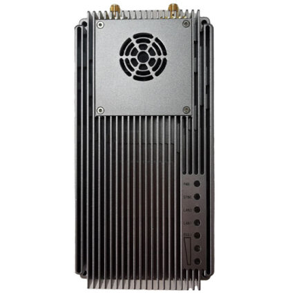
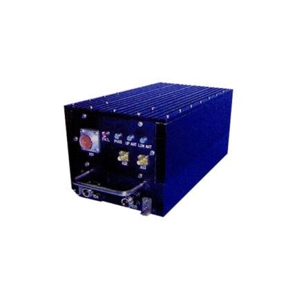
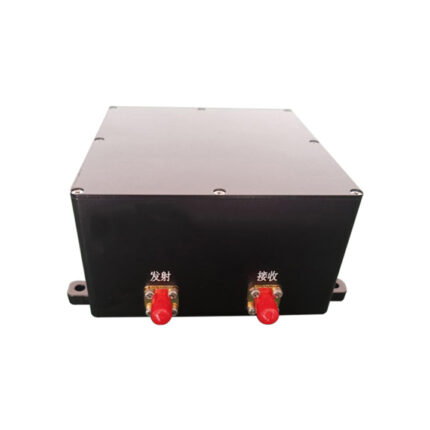
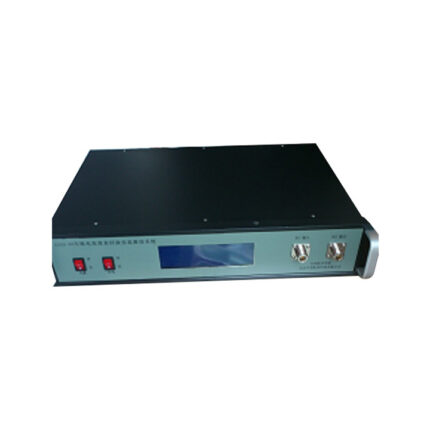
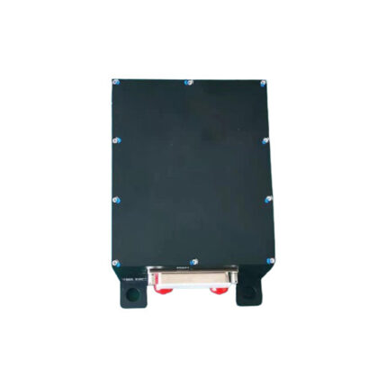
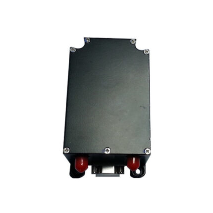
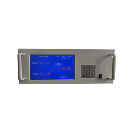
The MY-3001 series altimeters include models such as MY-3001A, MY-3001B, MY-3001C, MY-3001D, MY-3001E, MY-3001F, MY-3001G, and MY-3001H; as China’s smallest and lightest full-function radio altimeters that meet aerospace standards, they serve as key components for longitudinal height channel control and can be widely used in cruise missiles and UAVs to measure altitude relative to the sea or ground. The MY-3001 series altimeters adopt linear modulation coefficient technology adaptive to altitude changes and echo signal narrow-band receiving technology to enhance the product’s resistance to active interference, use coherent local oscillator mixing to achieve superior performance in resisting co-frequency asynchronous interference, employ echo signal spectrum front detection technology to improve tracking accuracy, and follow the three design principles of serialization, standardization, and modularization to enable high-speed production; additionally, built on a closed-loop tracking system, they integrate digital control technology, microwave integration technology, and hybrid integration technology to realize ultra-miniaturization of the product. As China’s first full-function radio altimeter, the series is known as the "high-speed rail ticket" in the industry.

MDG-400 Radio Altimeter

The MDG-400 radio altimeter operates in the C-band and adopts a frequency-modulated continuous wave (FMCW) working system, with its antenna utilizing a transmit-receive separation mode. Prior to missile launch, the altimeter (serving as the height-fixing device) is powered on, and it undergoes self-check and height presetting via the communication interface. After the missile is launched, the radio frequency (RF) module is activated, and frequency variation parameters are set based on the preset height. When the preset height is achieved, the altimeter outputs height-fixing command information and telemetry data. The MDG-400 altimeter features mature technology; its adoption of frequency-modulated continuous wave (FMCW) technology endows it with the advantages of compact size and a large height measurement range.

Radio Altimeter MY-3001D

The MY-3001D radio altimeter incorporates two key technologies: a linear modulation coefficient technology that adapts to altitude changes and a narrow-band receiving technology for echo signals, both of which effectively enhance the product’s resistance to active interference. It also adopts coherent local oscillator mixing, granting it superior performance in resisting co-frequency asynchronous interference, and employs echo signal spectrum front-edge detection technology to boost tracking accuracy. In terms of design, the altimeter follows the principles of serialization, standardization, and modularization. While retaining its closed-loop tracking system, it further integrates digital control technology, microwave integration technology, and hybrid integration technology to achieve product modularization. Additionally, it is equipped with a silent function, which further improves the product’s anti-interference capability. This radio altimeter is applicable to cruise missiles and unmanned aerial vehicles (UAVs) for measuring the altitude relative to the sea surface or the ground.

MASS-18 Universal Echo Precision Delay Module (Miniature Universal Continuous Simulation)

The MASS-18 Universal Echo Precision Delay Module, characterized by its miniature design and universal continuous simulation capability, is a high-precision component engineered for precise echo signal delay adjustment in radio frequency (RF) testing scenarios. It specializes in delivering accurate, customizable delay for echo signals across a broad frequency range, making it compatible with diverse RF devices—including radio altimeters, surveillance radars, and communication systems—that require reliable echo signal simulation. Its compact form factor allows easy integration into space-constrained test setups, while the universal continuous simulation function ensures consistent replication of real-world signal delay conditions (such as those caused by varying altitudes or distances). By enabling precise control over echo delay, the module plays a critical role in verifying key performance metrics of target devices, such as signal capture accuracy, delay response, and data processing reliability, thereby supporting the development, calibration, and quality assurance of high-performance RF equipment with flexibility and precision.​

MDG-200 Radio Altimeter

The MDG-200 radio height-setting device operates in the C-band and adopts a monopulse working system. Its sensitive component is of the heterodyne type, and the circulator at the antenna terminal uses a transceiver common-mode configuration. Prior to missile launch, the height-setting device needs to be powered on; it then performs a self-check and completes height setting via the communication interface. After the missile is launched, the radio frequency (RF) module is activated, and a gate is set based on the preconfigured height. When the preset height is reached, the device outputs height-setting command information and telemetry data. The MDG-200 height-setting device features mature technology: the monopulse design enhances the altimeter’s height measurement performance, and the device also has the characteristic of not being affected by the carrier’s speed.

CONTACT US

  • +86-755-21004586
    +86-18126437260
  • sales@moneyprouav.com
    moneyprouav@gmail.com
  • Office: East of the 16F, Building B, TCL Industrial Research Institute Building, No. 006, High-tech South Road, Nanshan District, Shenzhen City, China.
    Factory I: Building B , Gualan High-Technology Park, Longhua District, Shenzhen City, Guangdong Province.
    Factory II: Bajia Intelligent Equipment Garden, Boluo, Huizhou, Guangdong Province.
    Factory III: No. 169, Yingshanhong Road, Huangdao District, Qingdao City, Shandong Province.
  • What's App: +1-(213) 613-5938
    Telegram: +1-(213) 613-5938
    Wechat: +86-18126437260    
Product
  • UAV/Drones
    • Drone Hangar
    • Multi-rotor UAV
    • Single-rotor UAV
  • Airplane & VTOL
  • EO/IR Gimbal & Payload
  • Smart Robots & Cars
  • UAV Accessories
  • Anti Jamming & GNSS Antennas
  • Infrared Thermal & laser Sensing
  • Integrated Anti-Drone System
Support
  • Products Spec
  • Documents Download
  • Hardware Software
Video Center
  • UAV Video
  • Gimbal Camera Video
  • Unmanned Robots
About us
  • About Us
  • Contact us
Copyright © 2025 China Moneypro Group Corporation Limited. All Rights Reserved
  • Home
  • Product
    • UAV/Drones
      • Agricultural Drone
      • Multi-rotor UAV
      • Single-rotor UAV
      • Fiber Optic FPV Drone System
      • Multifunctional Drone
    • Airplane & VTOL
      • Petrol Electric Hybrid VTOL
      • Composite Wing Flight Platform
      • Tethered Drones
      • Tether Box
      • VTOL Fixed Wing UAV System
    • EO/IR Gimbal & Payload
      • Inspection & Filming Camera
      • Mapping & Surveying Camera
      • Package Delivery System
      • Security Camera
    • Smart Robots & Cars
      • Robotic Unmanned Ground Vehicle (UGV)
      • Unmanned Surface Vehicle USV
    • UAV Accessories
      • Propulsion System
      • Battery & Charger
      • Flight Controller & GPS & RTK
      • UAV RC & Ground Station
      • Turbojet Engine Systems
      • Drone Hangar
      • Inertial Navigation MEMS/IMU/Gyroscopes
      • Atmospheric Treatment
      • Data Communication
      • Partsassembly
      • Radar Detection
      • Scene Simulation
      • Drone Engine
    • Anti Jamming & GNSS Antennas
      • RTK GNSS Receiver
      • GNSS Module
      • Digital Communication Modules
      • Anti Jamming Sensor
      • GNSS Antenna
      • GNSS Receiver
      • RTK GNSS Antenna
      • RTK GNSS Board
      • Anti Jamming Antenna
    • Infrared Thermal & laser Sensing
      • Infrared Photoelectric imaging Solutions
      • Thermal Module
      • Laser Rangefinder
      • Thermal Imaging Binocular/ Monocular/ Variable Optic/ Observer
    • Integrated Anti-Drone System
      • Surveillance Rada Systems
    • Data Radio & Image Link
      • Wireless Networks Mesh Radio Systems
      • UAV Data link/Video transmission
      • UAV Ground Base Station
      • Robot Video and Data Transceiver Radio
      • Wireless Data Transceiver Radio
      • RF Module
      • OEM Customized
  • Products Capabilities
    • Agriculture Drone
    • Industrial Drone
    • Military and Police Drones
    • Specialized Drones
    • Underwater Drones
    • Educational/Entertainment Drones
    • EO/IR Gimbal camera payload
    • GPS RTK / GNSS Antenna Modules
    • Infrared Thermal & Laser Sensing systems
    • Radar Systems
    • Turbo Engines
    • Wireless Broadband Mesh Network Radio
  • Solution
  • About Us
    • Support
    • Video
    • Export Compliance Statement
  • News
  • FAQ
    • About Drones/UAV
    • About Gimbal Camera Payload
    • About Infrared Thermal Imaging Equipment
    • About Onboard Active Phased Array Radar
    • About Long-range Network Mesh Radio
    • About Anti-Jamming Antennas
    • About Integrated Anti-Drone Systems
    • About GNSS-antennas
    • About Turbojet Engines
  • Contact us

Sending...