Welcome To China Moneypro Official Website
Menu
Search
Browse Categories
  • UAV/Drones
  • Airplane & VTOL
  • EO/IR Gimbal & Payload
  • Smart Robots & Cars
  • UAV Accessories
  • Anti Jamming & GNSS Antennas
  • Infrared Thermal & laser Sensing
  • Integrated Anti-Drone System
  • Data Radio & Image Link
  • UAV RC & Ground Station
  • Flight Controller & GPS & RTK
  • Battery & Charger
  • Home
  • Product
    • UAV/Drones
      • Agricultural Drone
      • Multi-rotor UAV
      • Single-rotor UAV
      • Fiber Optic FPV Drone System
      • Multifunctional Drone
    • Airplane & VTOL
      • Petrol Electric Hybrid VTOL
      • Composite Wing Flight Platform
      • Tethered Drones
      • Tether Box
      • VTOL Fixed Wing UAV System
    • EO/IR Gimbal & Payload
      • Inspection & Filming Camera
      • Mapping & Surveying Camera
      • Package Delivery System
      • Security Camera
    • Smart Robots & Cars
      • Robotic Unmanned Ground Vehicle (UGV)
      • Unmanned Surface Vehicle USV
    • Anti Jamming & GNSS Antennas
      • RTK GNSS Receiver
      • GNSS Module
      • Digital Communication Modules
      • Anti Jamming Sensor
      • GNSS Antenna
      • GNSS Receiver
      • RTK GNSS Antenna
      • RTK GNSS Board
      • Anti Jamming Antenna
    • Infrared Thermal & laser Sensing
      • Infrared Photoelectric imaging Solutions
      • Thermal Module
      • Laser Rangefinder
      • Thermal Imaging Binocular/ Monocular/ Variable Optic/ Observer
    • UAV Accessories
      • Propulsion System
      • Battery & Charger
      • Flight Controller & GPS & RTK
      • UAV RC & Ground Station
      • Turbine Engine Systems
      • Drone Hangar
      • Inertial Navigation MEMS/IMU/Gyroscopes
      • Atmospheric Treatment
      • Data Communication
      • Partsassembly
      • Radar Detection
      • Scene Simulation
      • Drone Engine
    • Integrated Anti-Drone System
      • Surveillance Rada Systems
      • Anti-Jamming Antenna-a
      • Direction Finding Antenna-a
      • IMSI Catcher-a
      • Optoelectronics System-a
      • Pan & Tilt Turntable-a
      • Phased Array Radar-a
      • Signal Coverage-a
      • Signal Jammer-a
    • Data Radio & Image Link
      • Wireless Networks Mesh Radio Systems
      • UAV Data link/Video transmission
      • UAV Ground Base Station
      • Robot Video and Data Transceiver Radio
      • Wireless Data Transceiver Radio
      • RF Module
      • OEM Customized
  • Products Capabilities
    • Agriculture Drone
    • Industrial Drone
    • Military and Police Drones
    • Specialized Drones
    • Underwater Drones
    • Educational/Entertainment Drones
    • EO/IR Gimbal camera payload
    • GPS RTK / GNSS Antenna Modules
    • Infrared Thermal & Laser Sensing systems
    • Radar Systems
    • Turbo Engines
    • Wireless Broadband Mesh Network Radio
  • Solution
  • About Us
    • Support
    • Video
    • Export Compliance Statement
  • News
  • Blog
    • Buyer Guides
      • Counter Uas Buying Guide
      • Data Link Selection
      • Eo Ir Gimbal Camera Guide
      • Uav System Selection
      • Turbine Engine Selection
      • System Integration Considerations
      • Total Cost Of Ownership
    • Company Updates
      • Exhibitions And Events
      • Partnerships
      • Product Updates
      • Project Milestones
      • Quality And Compliance
    • Counter Uas
      • Airspace Monitoring
      • Counter Uas System Architecture
      • Rf Monitoring And Identification
      • Drone Detection Systems
      • Electro Optical Tracking
      • Multi Sensor Fusion
      • Radar Based Detection
      • Regulatory And Compliance
    • Data Link Communications
      • Anti Jamming Technologies
      • Encrypted Communications
      • Frequency Hopping
      • Link Reliability And Redundancy
      • Los And Blos Links
      • Low Latency Transmission
      • Mesh Networking
      • Satellite Communications
    • Defense Ai
      • Ai Model Deployment
      • Ai Sensor Fusion
      • Automatic Target Recognition
      • Decision Support Systems
      • Edge Ai Computing
      • Multi Object Tracking
      • Swarm Intelligence
      • Responsible Defense Ai
    • Industry Insights
      • Aviation Regulations
      • Defense And Uav Standards
      • Global Defense Exhibitions
      • Market Trends And Analysis
      • Nato And Military Standards
      • Supply Chain Analysis
      • Technology Roadmaps
    • Uav Technology
      • Propulsion Systems
      • Flight Control Systems
      • Composite Materials
      • Aerodynamic Design
      • Endurance Optimization
      • Redundancy And Reliability
      • Turbine Engine
      • Uav Payload Integration
    • Use Cases
      • Border Surveillance
      • Power Line Inspection
      • Wildfire Monitoring
      • Maritime Surveillance
      • Critical Infrastructure Protection
      • Disaster Response
      • Tactical Reconnaissance
  • FAQ
    • About Drones/UAV
    • About Gimbal Camera Payload
    • About Infrared Thermal Imaging Equipment
    • About Onboard Active Phased Array Radar
    • About Long-range Network Mesh Radio
    • About Anti-Jamming Antennas
    • About Integrated Anti-Drone Systems
    • About GNSS-antennas
    • About Turbojet Engines
  • Contact us
Click to enlarge
Home » Unmanned System Products » Radar Altimeter Working Scene Simulation System
M025A Receiver SD Integrated Receiver
Back to products
M027A Transmitter 4 Channel HD Bidirectional Digital Integrated Transmitter

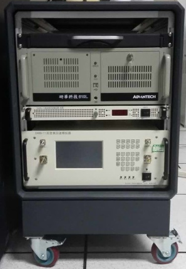
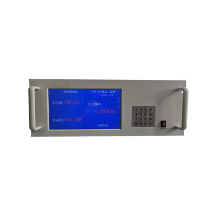
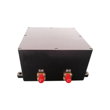
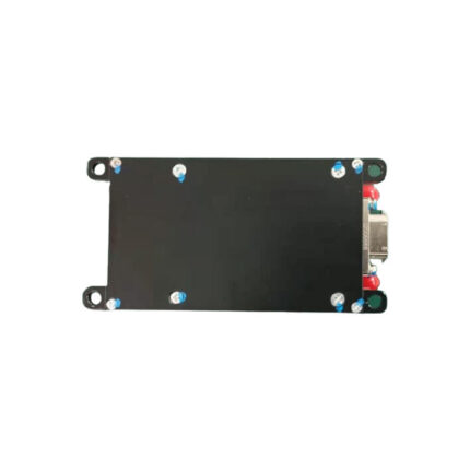
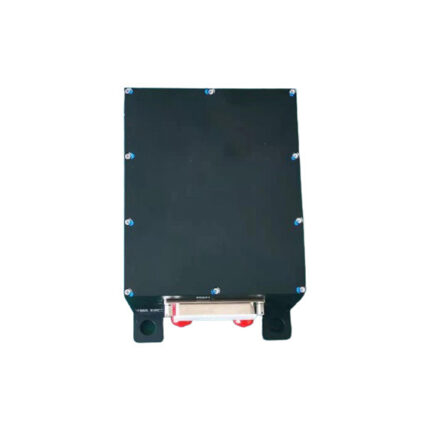
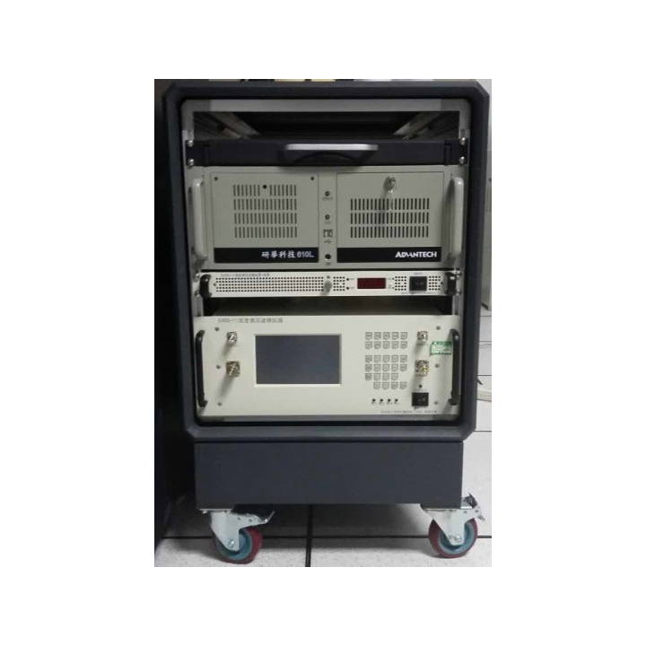
Radar Altimeter Working Scene Simulation System

The Radar Altimeter Echo Simulation System is designed to replicate the real-world operating scenarios of various radar altimeter systems. It generates and outputs radar altimeter echo excitation signals under complex working conditions, serving as a key tool for evaluating the comprehensive performance of radar altimeters.
This system is capable of simulating multiple critical signal scenarios, including radar altimeter echoes, surface target echoes, multi-path propagation of radar echoes during aircraft landing phases, radar altimeter echoes under different flight attitudes, forward and backward Doppler effects, and antenna direct wave signals. It is widely applied in testing the altitude-measuring performance of radar altimeters, as well as in verifying the functionality of altimeter control systems or integrated monitoring systems.
Categories: Atmospheric Treatment, Data Communication, Partsassembly, Radar Detection, Scene Simulation
Share:
  • Description
Description

Product Composition

The whole simulation system is mainly composed of microwave down conversion link, frequency synthesizer, up conversion link, delay line unit, power dynamic adjustment unit, baseband DRFM, main control unit and calibration unit.
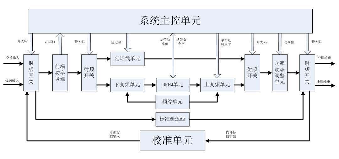
Radar Altimeter Working Scene Simulation System


Product Function

  • According to the information given by the simulation system, the echo signal of altimeter is generated in real time. The echo signal contains the core information of flight altitude, vertical velocity, echo attenuation and so on;
  • According to the flight attitude, antenna beam, beam direction, reflector scattering characteristics and other information, the plane target scene can be output in real time;
  • According to the characteristics of the aircraft loaded on the radar altimeter, the multiple travel signals of the radar echo are calculated in real time when approaching near zero altitude;
  • The performance of radar altimeter is evaluated based on the measurement results of radar altimeter;
  • The output signal power of dynamic continuous altitude, static altitude and Doppler effect can be simulated manually to meet various test functions.
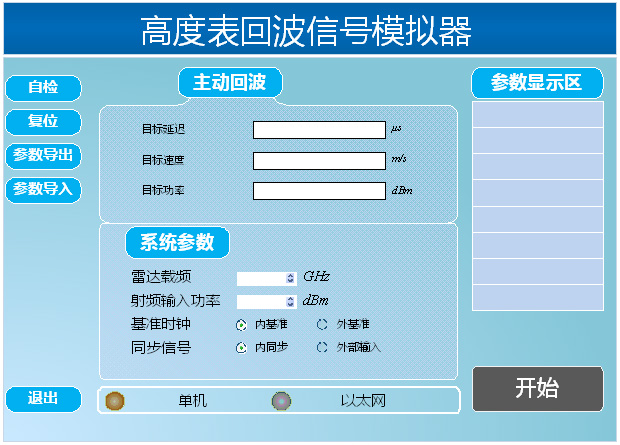
Radar Altimeter Working Scene Simulation System


Technical Index

  • Applicable radar system: radio altimeter and radar altimeter;
  • Target echo type: point target echo and surface target echo;
  • Multiple travel echo in the site: not less than 5 trips;
  • Direct wave signal position: 0-10m;
  • Frequency of work center: 4.3GHz (customizable);
  • The range of simulated height: 0.5~30000m;
  • Simulation height resolution: 0.1m;
  • Simulation height accuracy: ±(0.2+0.002×H)m;
  • Doppler: 500k~500k;
  • Attitude: pitch and roll 45°.

Radar Altimeter Working Scene Simulation System

Radar Altimeter Working Scene Simulation System

Related products

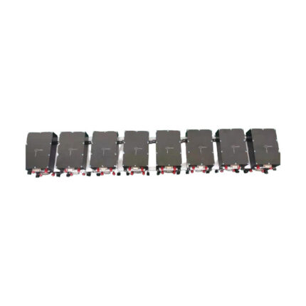
MASS-21 Echo Simulator of Radio Altimeter

​The MASS-21 Radio Altimeter Echo Simulator is capable of simulating both static and dynamic echo signals of altimeters under a variety of altitude conditions and reflection coefficient scenarios. It is compatible with radio altimeters of multiple systems, including frequency modulation (FM) systems, phase modulation (PM) systems, and pulse systems, and is also equipped with a built-in self-check function to ensure its own operational reliability during use.

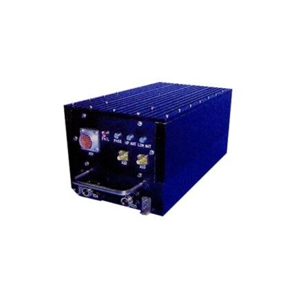
MDG-300 Radio Altimeter

The MDG-300 radio height-fixing device operates in the C-band and adopts a pulse compression system. Its sensitive component is of the heterodyne type, and the circulator at the antenna terminal uses a transceiver common-mode design. Prior to missile launch, the height-fixing device is powered on, and it undergoes self-check and height presetting via the communication interface. After the missile is launched, the radio frequency (RF) module is activated, and a gate is set in accordance with the preset height. When the preset height is reached, the device outputs height-fixing command information and telemetry data. The MDG-300 height-fixing device features mature technology: its pulse compression technology can enhance the altimeter’s height measurement performance, and it has the characteristic of a wide height measurement range. Additionally, the digital pulse compression function based on FPGA (Field-Programmable Gate Array) endows it with advantages such as small size, low power consumption, and low cost.

Radio Altimeter MY-3001M

The MY-3001m radio altimeter is a radar altimeter developed for the Rainbow XX UAV by a specific institute. It is widely used in UAVs to measure the altitude relative to the sea surface or the ground. This altimeter incorporates a linear modulation coefficient technology adaptable to altitude changes and a narrow-band receiving technology for echo signals, which enhances the product’s resistance to active interference. It also adopts coherent local oscillator mixing, delivering superior performance in resisting synchronous interference, and employs echo signal spectrum front-edge detection technology to improve tracking accuracy. Additionally, it features a three-dimensional design based on serialization, standardization, and modularization, endowing the product with excellent inheritance, maturity, and reliability. While retaining the closed-loop tracking system, the MY-3001m radio altimeter further adopts digital control technology, microwave integration technology, and hybrid integration technology to achieve product modularization. Moreover, its receiver is equipped with dual filters, which further boosts the product’s anti-interference capability.

Radio Altimeter MY-3001D

The MY-3001D radio altimeter incorporates two key technologies: a linear modulation coefficient technology that adapts to altitude changes and a narrow-band receiving technology for echo signals, both of which effectively enhance the product’s resistance to active interference. It also adopts coherent local oscillator mixing, granting it superior performance in resisting co-frequency asynchronous interference, and employs echo signal spectrum front-edge detection technology to boost tracking accuracy. In terms of design, the altimeter follows the principles of serialization, standardization, and modularization. While retaining its closed-loop tracking system, it further integrates digital control technology, microwave integration technology, and hybrid integration technology to achieve product modularization. Additionally, it is equipped with a silent function, which further improves the product’s anti-interference capability. This radio altimeter is applicable to unmanned aerial vehicles (UAVs) for measuring the altitude relative to the sea surface or the ground.

Small Radio Altimeter MY-1000

The MY-1000 altimeter is a radar altimeter specially designed for a specific type of target missile aircraft; as a compact, full-function radio altimeter that complies with aerospace standards, it serves as a key component for longitudinal altitude channel control and can be widely used in UAVs to measure height relative to sea level or the ground. The MY-1000 adopts linear modulation coefficient technology adaptive to height changes and echo signal narrow-band receiving technology to enhance the product’s resistance to active interference, uses coherent local oscillator mixing to achieve superior performance in resisting co-frequency asynchronous interference, employs echo signal spectrum front detection technology to improve tracking accuracy, and follows the three design principles of serialization, standardization, and modularization—endowing it with good product inheritance, maturity, and reliability.

MY-5001B Radio Altimeter for Sea Condition Identification

The MY-5001B radio altimeter is an all-solid-state C-band device featuring a frequency-modulated continuous wave (FM-CW) system, a constant differential beat frequency, and a closed-loop tracking and measurement mechanism. It ensures a constant beat frequency through servo control of the slope of the sawtooth wave that modulates the microwave oscillator, thereby achieving automatic height tracking. This altimeter incorporates a suite of advanced technologies, including narrowband reception, weighted frequency discrimination, equivalent spectrum leading edge detection, gain PID control, instantaneous sensitivity compensation, temperature compensation, horizon frequency selection design, and power silence. These technologies collectively endow it with advantages such as accurate height measurement, stable tracking, adaptability to various terrains, a wide height measurement range, high precision, and strong anti-interference capabilities.

Subminiature Radio Altimeter MY-70A

The MY-70A radio altimeter is a solid-state C-band radio altimeter system based on frequency-modulated continuous wave (FMCW) technology, featuring constant beat frequency and closed-loop tracking measurement. It maintains a constant beat frequency by servo-controlling the slope of the sawtooth wave that modulates the microwave oscillator, thereby achieving automatic altitude tracking. Under the condition of a constant beat frequency, the measured altitude is proportional to the modulation period; thus, altitude information can be acquired by measuring the modulation period, and the system then converts this information into an altitude voltage for output. The MY-70A altimeter boasts excellent anti-jamming performance, thanks to its adoption of a narrow-band receiver (with gain adjustable according to altitude), as well as technologies including equivalent spectrum front-end detection, weighted frequency identification, and automatic servo tracking. Additionally, the altimeter’s high-frequency components are implemented with microwave integration, while its low-frequency components utilize a modular design—these measures collectively enhance the product’s reliability, anti-interference capability, and electromagnetic compatibility.

MDY-71/74 Millimeter Wave Guidance Radar

The MDY-71/74 demonstration radar is a compact millimeter-wave coherent guidance radar that utilizes a phase difference system. It boasts key features including low cost, low power consumption, and high reliability, enabling it to detect and track targets—such as vehicles and vessels—within its beam coverage. Additionally, this radar can provide critical target information like distance and angle, while also supporting situational display functionality.

CONTACT US

  • +86-755-21004586
    +86-18126437260
  • sales@moneyprouav.com
    moneyprouav@gmail.com
  • Office: East of the 16F, Building B, TCL Industrial Research Institute Building, No. 006, High-tech South Road, Nanshan District, Shenzhen City, China.
    Factory I: Building B , Gualan High-Technology Park, Longhua District, Shenzhen City, Guangdong Province.
    Factory II: Bajia Intelligent Equipment Garden, Boluo, Huizhou, Guangdong Province.
    Factory III: No. 169, Yingshanhong Road, Huangdao District, Qingdao City, Shandong Province.
  • What's App: +1-(213) 613-5938
    Telegram: +1-(213) 613-5938
    Wechat: +86-18126437260    
Product
  • UAV/Drones
    • Drone Hangar
    • Multi-rotor UAV
    • Single-rotor UAV
  • Airplane & VTOL
  • EO/IR Gimbal & Payload
  • Smart Robots & Cars
  • UAV Accessories
  • Anti Jamming & GNSS Antennas
  • Infrared Thermal & laser Sensing
  • Integrated Anti-Drone System
Support
  • Products Spec
  • Documents Download
  • Hardware Software
Video Center
  • UAV Video
  • Gimbal Camera Video
  • Unmanned Robots
About us
  • About Us
  • Contact us
Copyright © 2025 China Moneypro Group Corporation Limited. All Rights Reserved
  • Home
  • Product
    • UAV/Drones
      • Agricultural Drone
      • Multi-rotor UAV
      • Single-rotor UAV
      • Fiber Optic FPV Drone System
      • Multifunctional Drone
    • Airplane & VTOL
      • Petrol Electric Hybrid VTOL
      • Composite Wing Flight Platform
      • Tethered Drones
      • Tether Box
      • VTOL Fixed Wing UAV System
    • EO/IR Gimbal & Payload
      • Inspection & Filming Camera
      • Mapping & Surveying Camera
      • Package Delivery System
      • Security Camera
    • Smart Robots & Cars
      • Robotic Unmanned Ground Vehicle (UGV)
      • Unmanned Surface Vehicle USV
    • Anti Jamming & GNSS Antennas
      • RTK GNSS Receiver
      • GNSS Module
      • Digital Communication Modules
      • Anti Jamming Sensor
      • GNSS Antenna
      • GNSS Receiver
      • RTK GNSS Antenna
      • RTK GNSS Board
      • Anti Jamming Antenna
    • Infrared Thermal & laser Sensing
      • Infrared Photoelectric imaging Solutions
      • Thermal Module
      • Laser Rangefinder
      • Thermal Imaging Binocular/ Monocular/ Variable Optic/ Observer
    • UAV Accessories
      • Propulsion System
      • Battery & Charger
      • Flight Controller & GPS & RTK
      • UAV RC & Ground Station
      • Turbine Engine Systems
      • Drone Hangar
      • Inertial Navigation MEMS/IMU/Gyroscopes
      • Atmospheric Treatment
      • Data Communication
      • Partsassembly
      • Radar Detection
      • Scene Simulation
      • Drone Engine
    • Integrated Anti-Drone System
      • Surveillance Rada Systems
      • Anti-Jamming Antenna-a
      • Direction Finding Antenna-a
      • IMSI Catcher-a
      • Optoelectronics System-a
      • Pan & Tilt Turntable-a
      • Phased Array Radar-a
      • Signal Coverage-a
      • Signal Jammer-a
    • Data Radio & Image Link
      • Wireless Networks Mesh Radio Systems
      • UAV Data link/Video transmission
      • UAV Ground Base Station
      • Robot Video and Data Transceiver Radio
      • Wireless Data Transceiver Radio
      • RF Module
      • OEM Customized
  • Products Capabilities
    • Agriculture Drone
    • Industrial Drone
    • Military and Police Drones
    • Specialized Drones
    • Underwater Drones
    • Educational/Entertainment Drones
    • EO/IR Gimbal camera payload
    • GPS RTK / GNSS Antenna Modules
    • Infrared Thermal & Laser Sensing systems
    • Radar Systems
    • Turbo Engines
    • Wireless Broadband Mesh Network Radio
  • Solution
  • About Us
    • Support
    • Video
    • Export Compliance Statement
  • News
  • Blog
    • Buyer Guides
      • Counter Uas Buying Guide
      • Data Link Selection
      • Eo Ir Gimbal Camera Guide
      • Uav System Selection
      • Turbine Engine Selection
      • System Integration Considerations
      • Total Cost Of Ownership
    • Company Updates
      • Exhibitions And Events
      • Partnerships
      • Product Updates
      • Project Milestones
      • Quality And Compliance
    • Counter Uas
      • Airspace Monitoring
      • Counter Uas System Architecture
      • Rf Monitoring And Identification
      • Drone Detection Systems
      • Electro Optical Tracking
      • Multi Sensor Fusion
      • Radar Based Detection
      • Regulatory And Compliance
    • Data Link Communications
      • Anti Jamming Technologies
      • Encrypted Communications
      • Frequency Hopping
      • Link Reliability And Redundancy
      • Los And Blos Links
      • Low Latency Transmission
      • Mesh Networking
      • Satellite Communications
    • Defense Ai
      • Ai Model Deployment
      • Ai Sensor Fusion
      • Automatic Target Recognition
      • Decision Support Systems
      • Edge Ai Computing
      • Multi Object Tracking
      • Swarm Intelligence
      • Responsible Defense Ai
    • Industry Insights
      • Aviation Regulations
      • Defense And Uav Standards
      • Global Defense Exhibitions
      • Market Trends And Analysis
      • Nato And Military Standards
      • Supply Chain Analysis
      • Technology Roadmaps
    • Uav Technology
      • Propulsion Systems
      • Flight Control Systems
      • Composite Materials
      • Aerodynamic Design
      • Endurance Optimization
      • Redundancy And Reliability
      • Turbine Engine
      • Uav Payload Integration
    • Use Cases
      • Border Surveillance
      • Power Line Inspection
      • Wildfire Monitoring
      • Maritime Surveillance
      • Critical Infrastructure Protection
      • Disaster Response
      • Tactical Reconnaissance
  • FAQ
    • About Drones/UAV
    • About Gimbal Camera Payload
    • About Infrared Thermal Imaging Equipment
    • About Onboard Active Phased Array Radar
    • About Long-range Network Mesh Radio
    • About Anti-Jamming Antennas
    • About Integrated Anti-Drone Systems
    • About GNSS-antennas
    • About Turbojet Engines
  • Contact us

Sending...