Introduction to Photogrammetry at Scale
In the rapidly evolving landscape of 2026, aerial surveying has moved beyond simple imagery into the realm of high-precision digital twins. For surveyors and engineers, the choice of platform is critical. From our experience at China Moneypro, we have seen a decisive shift away from hobbyist-grade equipment toward industrial-grade fixed-wing platforms. When you are tasked with mapping thousands of hectares, the best fixed wing drone for photogrammetry is defined not just by its camera, but by its endurance, stability, and data integrity.
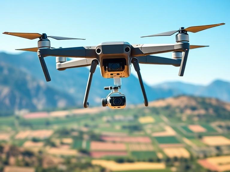
Table of Contents
Photogrammetry requires a stable platform capable of maintaining a precise flight path while triggering a high-resolution global shutter camera. As professional providers in the UAV manufacturing space, we recommend focusing on airframe architecture that minimizes vibration and maximizes coverage per flight hour. In this guide, we evaluate the premier options currently dominating the global market.
Why Fixed Wing Trumps Multirotor for Mapping
While multirotors like the DJI M350 are excellent for small-site inspections, they lack the aerodynamic efficiency required for large-scale geospatial data acquisition. A fixed-wing drone uses its wings to generate lift, requiring significantly less power to stay airborne than a multirotor that must fight gravity constantly. This leads to flight times that are measured in hours rather than minutes.
From our experience, a high-quality fixed-wing platform can cover up to 10 times more area in a single sortie compared to a quadcopter. Furthermore, the linear flight speed of fixed-wing aircraft allows for a more consistent Ground Sampling Distance (GSD), which is vital for high-accuracy Orthomosaics and 3D models. We recommend fixed-wing systems for any project exceeding 50 hectares.
Key Performance Metrics for Photogrammetry
Before selecting the best fixed wing drone for photogrammetry, you must evaluate specific hardware requirements:
- Endurance: The ability to fly for 2+ hours significantly reduces the number of takeoffs and landings, which are the highest-risk portions of any mission.
- Payload Integration: The airframe must support high-end sensors such as the Sony A7R series or Phase One industrial cameras.
- PPK/RTK Support: To achieve centimeter-level accuracy without a massive array of Ground Control Points (GCPs), onboard GNSS correction is mandatory.
- Wind Resistance: Aerial mapping often takes place in coastal or mountainous regions where wind speeds can exceed 10m/s.
The 9 Best Fixed Wing Drones Reviewed
1. China Moneypro MVT390 Hybrid VTOL
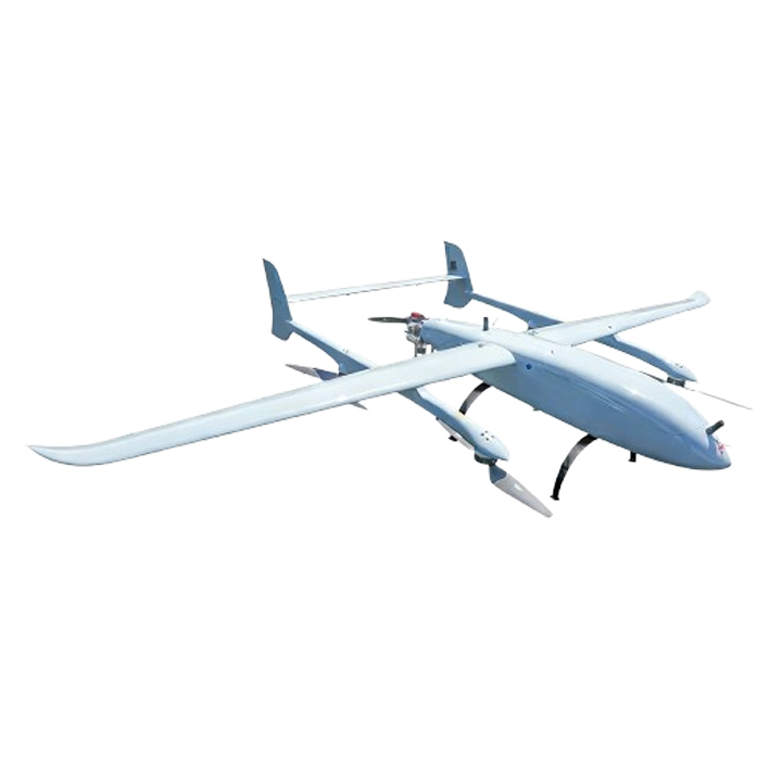
The China Moneypro MVT390 is a powerhouse in the industrial mapping sector. It combines the ease of a multirotor with the efficiency of a fixed-wing. With a robust 3.9m wingspan and a 10-hour flight time with a 5kg load, it is arguably the best fixed wing drone for photogrammetry in 2026 for large-scale infrastructure projects. Its carbon fiber and Kevlar construction ensures it can handle the rigors of field deployment while maintaining a massive MTOW of 35kg. For surveyors requiring deep-penetration LiDAR or dual-camera setups, the 8kg max payload capacity is revolutionary.
2. China Moneypro M630 Gasoline-Powered Drone
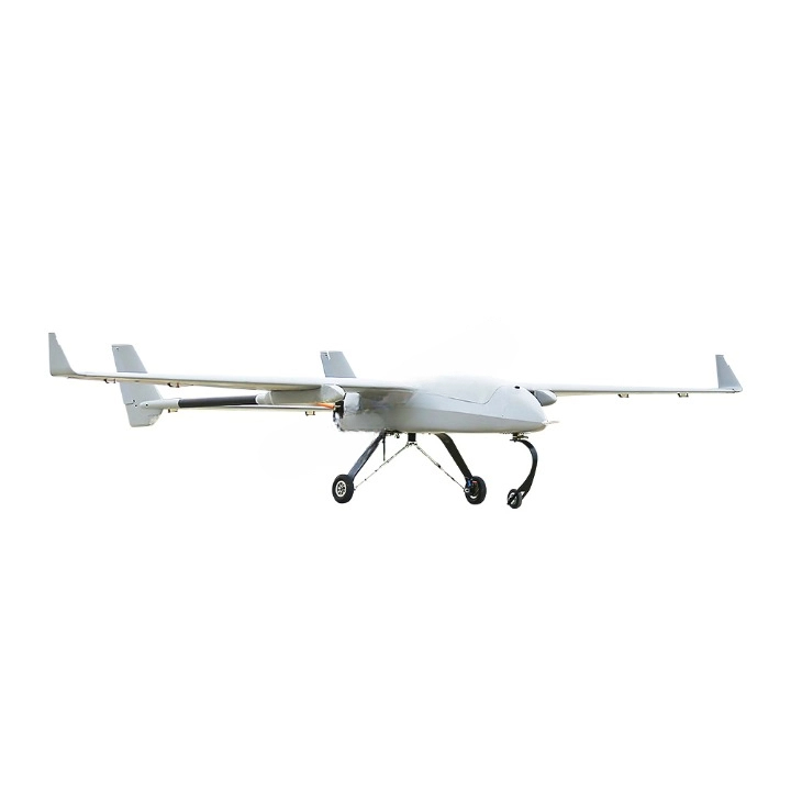
When the mission involves mapping entire counties or remote borders, the M630 stands alone. Utilizing a Limbach EFI powerhouse architecture with a 275cc fuel injection engine, it offers an incredible 12-hour endurance. We recommend this for BVLOS (Beyond Visual Line of Sight) operations where reliability is paramount. Its redundant systems, including dual ignition and ECU failover, have earned it a 200-hour MTBF certification from TÜV Rheinland. With a 50kg payload capacity, it can carry the world’s most advanced multi-spectral and photogrammetric sensors simultaneously.
3. WingtraOne Gen II
A favorite for mid-range surveying, the WingtraOne is famous for its “tailsitter” VTOL design. It excels in high-resolution mapping using its 42MP Sony RX1RII camera. While its flight time is shorter than our HVT390, its ease of use in confined spaces makes it a strong contender for the best fixed wing drone for photogrammetry in urban environments.
4. eBee X by AgEagle
The eBee series has been a staple in the industry for a decade. The eBee X is lightweight and incredibly safe to fly over people due to its foam construction. It is a dedicated mapping tool, though it lacks the payload flexibility found in larger carbon-fiber airframes. From our experience, it is an excellent “entry-level” professional fixed-wing for agricultural mapping.
5. Quantum Systems Trinity F90+
The Trinity F90+ is a German-engineered VTOL that provides up to 90 minutes of flight time. It features a sophisticated payload bay that allows for quick swapping of sensors. We recommend this for teams that need to switch between RGB photogrammetry and LiDAR in a single day.
6. Vertical Technologies DeltaQuad Pro
The DeltaQuad Pro is a versatile VTOL platform with a reputation for autonomous reliability. It offers a 100km range on a single battery charge. While it doesn’t match the 10-hour endurance of the MVT390, it provides a solid middle ground for regional mapping tasks.
7. JOUAV CW-15
The CW-15 is another high-end VTOL fixed-wing that is frequently used for digital city modeling. It features advanced flight control systems and high wind resistance, making it suitable for high-altitude surveying up to 4000m.
8. Delair UX11
The UX11 is a professional mapping drone with integrated 3G/4G connectivity for BVLOS operations. It is designed for “black-box” simplicity, where the drone handles most of the sensor calibration automatically. It is a highly efficient, small-scale mapping solution.
9. BirdsEyeView FireFLY6 PRO
This is a versatile DIY-friendly professional platform. It uses a Y6 multirotor configuration for VTOL and transitions to efficient forward flight. It is highly customizable, though from our experience, it requires a more skilled technician for maintenance compared to our MVT390 or M630 series.
Technical Comparison Table
| Model | Wingspan | Max Flight Time | Max Payload | Power Source |
|---|---|---|---|---|
| China Moneypro MVT390 | 3920mm | 10 Hours | 8kg | Hybrid/Electric |
| China Moneypro M630 | Variable | 12 Hours | 50kg | Gasoline (EFI) |
| WingtraOne Gen II | 1250mm | 59 Minutes | 0.8kg | Electric |
| Quantum Systems Trinity | 2394mm | 90 Minutes | 0.7kg | Electric |
| eBee X | 1160mm | 90 Minutes | Variable | Electric |
The Rise of Hybrid VTOL Systems
One of the biggest hurdles for traditional fixed-wing drones was the requirement for a runway or a catapult launcher. In 2026, the best fixed wing drone for photogrammetry almost always utilizes VTOL (Vertical Take-Off and Landing) technology. From our experience, VTOL systems like the China Moneypro MVT390 eliminate the risk of “belly landing” damage, which is common in older fixed-wing models.
The MVT390’s hybrid architecture allows it to take off in a 5×5 meter area, even in rugged terrain, and then transition to high-speed cruising at 144km/h. This flexibility, combined with a 10-hour endurance, represents the current “Gold Standard” for expeditionary mapping. We recommend hybrid systems because they protect your expensive photogrammetry sensors during the landing phase, which is traditionally where 90% of airframe wear occurs.
Frequently Asked Questions
References
- Geospatial World: The Evolution of Fixed-Wing UAVs in Surveying. View Source
- TÜV Rheinland: Reliability Standards for Industrial UAVs 2026. View Source
- China Moneypro: Technical Blueprint for the HVT390 VTOL Series.
Choosing the best fixed wing drone for photogrammetry is a decision that impacts your data quality and operational safety for years. Whether you need the massive 10-hour endurance of the China Moneypro MVT390 or the extreme payload capacity of the M630, our team is here to help you design the ultimate mapping fleet. Would you like me to provide a custom payload configuration for your specific surveying needs?