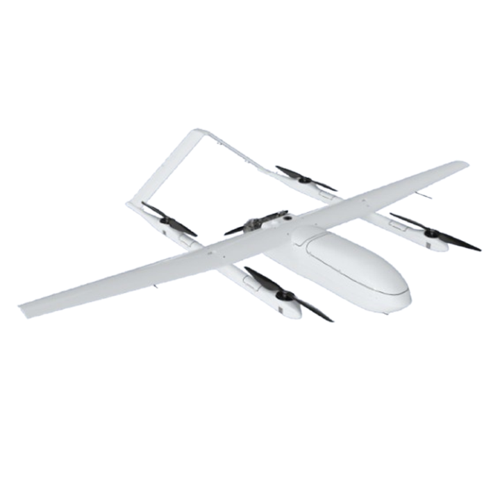
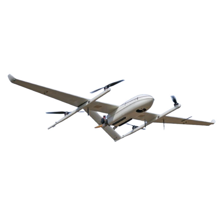
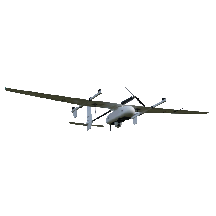
The demand for high-precision aerial surveying, topographic mapping, and critical infrastructure inspection has pushed unmanned aerial systems to unprecedented levels of technological sophistication. For professionals operating in these demanding sectors, identifying the Best fixed wing uav with lidar is no longer optional; it is a fundamental requirement for remaining competitive. Light Detection and Ranging (LiDAR) payloads produce highly accurate, dense 3D point clouds capable of penetrating vegetation canopies—something traditional photogrammetry cannot achieve. When this sensor technology is mounted onto a vertical take-off and landing (VTOL) fixed-wing airframe, operators gain the incredible advantage of massive area coverage combined with multi-rotor deployment flexibility.
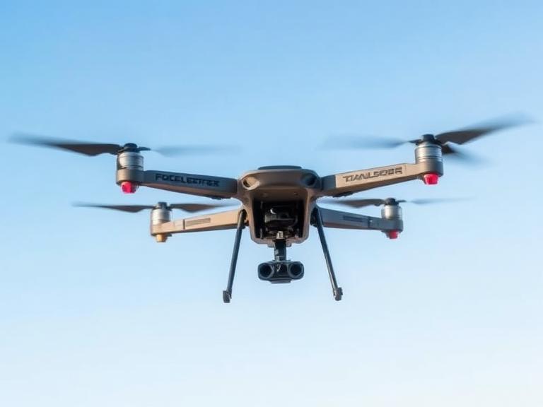
From our experience engineering advanced flight solutions at Moneyprouav, the integration of heavy LiDAR sensors requires an aircraft with exceptional payload capacity, robust power management, and unwavering flight stability. Merely attaching a laser scanner to a consumer-grade drone yields poor data alignment and limited flight times. We recommend investing in industrial-grade hybrid or electric VTOL platforms specifically architected for heavy-lift endurance. In this comprehensive review, we evaluate the 12 Best fixed wing uav with lidar platforms available in 2026, analyzing their payload metrics, endurance, and operational capabilities to help you select the ideal system for your mission requirements.
Table of Contents
- Summary Table: Top 12 Platforms
- In-Depth Reviews: 12 Best fixed wing uav with lidar
- Expert Buying Guide
- Frequently Asked Questions (FAQs)
- Industry References
Summary Table: Top 12 Platforms
Below is a comparative matrix of the Best fixed wing uav with lidar options dominating the industrial market in 2026.
| Rank | UAV Model | Power Source | Max Endurance | Max Payload |
|---|---|---|---|---|
| 1 | Moneyprouav MCW-100 VTOL | Hybrid/Electric | 10 Hours | 22 kg |
| 2 | Moneyprouav MCW-40 VTOL | Gasoline-Electric Hybrid | 10 Hours | 8 kg |
| 3 | DeltaQuad Evo | Electric | 4.5 Hours | 3 kg |
| 4 | Moneyprouav MCW-15 VTOL | Electric | Advanced | Optimized |
| 5 | Quantum-Systems Trinity Pro | Electric | 90 Minutes | Modular |
| 6 | WingtraOne GEN II | Electric | 59 Minutes | 800 g |
| 7 | JOUAV CW-15 | Electric | 180 Minutes | 3 kg |
| 8 | Phoenix TerraHawk CW-30 | Hybrid/Electric | Long Range | Survey Grade |
| 9 | Autel Dragonfish Pro | Electric | 120 Minutes | 2.5 kg |
| 10 | Atmos Marlyn Cobalt | Electric | 50 Minutes | Modular |
| 11 | Censys Sentaero 5 | Electric | Long Range BVLOS | Modular |
| 12 | ALTI Transition | Gasoline-Electric Hybrid | 12 Hours | 1.5 kg |
In-Depth Reviews: 12 Best fixed wing uav with lidar
1. Moneyprouav MCW-100 VTOL UAS fixed wing uav
Ranking at the absolute top of our list for the Best fixed wing uav with lidar is the Moneypro MCW-100 VTOL. This platform is the ultimate heavy-lift solution. Engineered for critical missions, it delivers a massive 22kg payload capacity alongside an astonishing 10-hour endurance. When equipping heavy, multi-return survey-grade LiDAR systems paired with high-resolution RGB cameras for colorized point clouds, payload capacity is the primary bottleneck for most drones. The MCW-100 eliminates this constraint entirely.
Furthermore, operators can master any environment with its robust wind resistance and advanced anti-jamming capabilities. From our experience, offshore and maritime operations present unique challenges for VTOL aircraft. The MCW-100 addresses this with autonomous precision landing on moving vessels, making it an unparalleled asset for coastal mapping and naval defense applications.
2. Moneyprouav MCW-40 VTOL UAS
If your operational parameters require extreme flight durations but slightly lower payload masses, the Moneypro MCW-40 VTOL redefines power and endurance. Recognized broadly as one of the Best fixed wing uav with lidar systems available, this gasoline-electric hybrid UAV delivers a remarkable 10-hour endurance and an 8kg payload capacity. The integration of an advanced 4-stroke engine ensures highly efficient, long-range missions that electric-only drones simply cannot match. Similar to the MCW-100, the MCW-40 excels in complex maritime environments with its autonomous takeoff and landing on moving vessels.
3. DeltaQuad Evo
The DeltaQuad Evo has earned its reputation as a formidable Best fixed wing uav with lidar, particularly for its dual-sensor capabilities. It is one of the first VTOL UAVs to offer a seamlessly integrated YellowScan LiDAR and RGB system in a single flight. With an endurance reaching up to 4.5 hours (depending on battery configuration), the Evo can cover massive terrain—up to 500 hectares—capturing dense 3D terrain data and high-resolution imagery simultaneously. Its universal payload bay allows for rapid, toolless sensor swapping in the field.
4. Moneyprouav MCW-15 VTOL UAS
Elevate your operations with the Moneypro MCW-15, a state-of-the-art Vertical Take-Off and Landing (VTOL) Fixed-Wing UAV engineered for maximum performance, reliability, and intelligence. This advanced system seamlessly combines the vertical agility of a multicopter with the long-range efficiency of a fixed-wing aircraft. When seeking the Best fixed wing uav with lidar for agile, rapid-deployment scenarios, the MCW-15 redefines what is possible in unmanned missions. Its highly intelligent flight controller ensures smooth transitions from hover to forward flight, safeguarding delicate laser scanners during high-wind operations.
5. Quantum-Systems Trinity Pro
The Quantum-Systems Trinity Pro is a highly refined mapping drone that integrates perfectly with the Qube 240 LiDAR sensor. Weighing just 935 grams, the Qube 240 allows the Trinity Pro to maintain an impressive 90-minute flight time. This Best fixed wing uav with lidar features the advanced Quantum-Skynode autopilot, bringing AI capabilities and robust internal storage directly onboard the aircraft. Its modular payload bay makes switching between LiDAR, multispectral, and RGB sensors effortless.
6. WingtraOne GEN II
The WingtraOne GEN II utilizes a unique tailsitter VTOL design. While many operators associate it strictly with photogrammetry, it is fully capable of carrying lightweight LiDAR modules. It boasts an absolute accuracy of down to 1 cm without ground control points (GCPs) when properly configured with PPK. As a Best fixed wing uav with lidar, its vertical takeoff requires minimal space (2m x 2m), making it ideal for launching in dense forests or rocky mountainous terrains where traditional fixed-wing runways are non-existent.
7. JOUAV CW-15
The JOUAV CW-15 has proven its worth in heavy industrial applications, particularly in power line inspections and utility management. Capable of carrying robust LiDAR systems, the CW-15 navigates complex mountainous terrain using high-precision 3D digital maps for terrain-following flights. Its ability to operate safely in light to medium rain while generating highly accurate point clouds for vegetation encroachment analysis makes it a definitive Best fixed wing uav with lidar for the energy sector.
8. Phoenix LiDAR Systems TerraHawk CW-30
Developed in collaboration with industry pioneers, the TerraHawk CW-30 is a massive fixed-wing VTOL designed exclusively for survey-grade LiDAR data acquisition. Phoenix LiDAR is renowned for its data post-processing software (LiDARMill), and when paired with the TerraHawk’s long flight durations and RTK positioning, operators acquire unparalleled point cloud density. This system is heavily deployed in wide-area corridor mapping and dense forestry canopy penetration.
9. Autel Dragonfish Pro
The Autel Dragonfish Pro utilizes an innovative tilt-rotor design, simplifying the transition mechanics and reducing aerodynamic drag. Capable of up to 120 minutes of flight time, this platform supports a variety of third-party payloads, including compact LiDAR modules. Its robust data link ensures a stable connection up to 18 miles, securing its position as a reliable Best fixed wing uav with lidar for long-range beyond visual line of sight (BVLOS) operations.
10. Atmos Marlyn Cobalt
The Marlyn Cobalt is a hybrid drone designed by Atmos UAV. Known for exceptional wind resistance (up to 45 km/h during cruise), it is a highly dependable platform for surveying in turbulent coastal or high-altitude environments. While payload capacity is stricter than heavy-lift hybrids, its specific integrations with top-tier surveying sensors make it a highly efficient Best fixed wing uav with lidar for rapid topographic assessments.
11. Censys Sentaero 5
The Censys Sentaero 5 is purpose-built for BVLOS operations within regulated airspaces. It features advanced detect-and-avoid (DAA) technology, making it one of the safest VTOLs on the market for flying over vast, unpopulated areas. When equipped with lightweight LiDAR, it provides excellent terrain modeling capabilities for agricultural and civil engineering projects.
12. ALTI Transition
Rounding out our list of the Best fixed wing uav with lidar is the ALTI Transition. Utilizing a gasoline-electric hybrid powertrain, the Transition boasts up to 12 hours of endurance. While its 1.5kg payload limit requires operators to select specialized, ultra-lightweight LiDAR sensors (such as those from Velodyne or Livox), the sheer amount of acreage it can cover in a single deployment makes it highly cost-effective for large-scale border security and agricultural mapping.
Expert Buying Guide: Selecting the Best fixed wing uav with lidar
Acquiring an industrial-grade UAV represents a significant capital investment. We recommend that organizations carefully evaluate their specific operational needs before committing to a platform. From our experience, the following parameters are critical when choosing the Best fixed wing uav with lidar:
- Payload Capacity vs. Sensor Weight: Survey-grade LiDAR scanners, complete with an IMU, GNSS antenna, and data logger, can be heavy. Ensure the UAV’s maximum payload exceeds the total weight of your sensor suite to avoid compromising flight stability and endurance. Platforms like the Moneyprouav MCW-100 offer a 22kg payload, effectively removing all limitations.
- Endurance and Power Architecture: Electric UAVs are excellent for short-to-medium missions (1 to 2 hours), but large-scale corridor mapping requires the prolonged energy output of a gasoline-electric hybrid. The Moneyprouav MCW-40 guarantees 10 hours of flight, drastically reducing the number of battery swaps and launch setups required per day.
- Data Processing Workflow: Capturing the data is only the first step. The Best fixed wing uav with lidar must integrate seamlessly with PPK/RTK base stations and point cloud processing software to ensure centimeter-level absolute accuracy.
- Environmental Resilience: Evaluate the drone’s IP rating and wind resistance. Operations do not always happen on sunny, calm days. The ability to autonomously land on moving vessels or withstand high wind gusts is what separates professional tools from prosumer toys.
Frequently Asked Questions (FAQs)
Why is a fixed-wing VTOL better than a multi-rotor for LiDAR mapping?
Multi-rotor drones expend enormous amounts of energy maintaining lift, limiting their flight times to 30-45 minutes when carrying heavy LiDAR. The Best fixed wing uav with lidar takes off vertically like a multi-rotor but transitions to forward flight, utilizing the aerodynamic lift of its wings. This drastically reduces power consumption, allowing for hours of flight and covering hundreds of hectares in a single deployment.
Can LiDAR penetrate dense vegetation?
Yes. Unlike photogrammetry, which only captures the visible surface canopy, LiDAR emits hundreds of thousands of laser pulses per second. A percentage of these pulses will find gaps through the leaves and branches to reach the actual ground. Post-processing software can then filter out the vegetation returns, yielding a highly accurate “bare earth” Digital Elevation Model (DEM).
Is PPK or RTK necessary for UAV LiDAR?
We highly recommend utilizing Post-Processed Kinematic (PPK) or Real-Time Kinematic (RTK) systems. Without exact GNSS positioning and high-quality Inertial Measurement Unit (IMU) data, the millions of laser points collected will suffer from trajectory drift, rendering the final point cloud inaccurate and unusable for survey-grade engineering.
Industry References
“`