


Navigating the modern airspace is a hostile endeavor. If you are operating a commercial or defense-grade unmanned aerial vehicle (UAV), relying exclusively on standard satellite positioning is a guaranteed path to catastrophic mission failure. In highly contested environments characterized by electronic warfare, urban canyons, and intentional signal spoofing, the architecture of your flight controller’s navigation suite dictates whether your aircraft returns home or falls out of the sky. This is where the GNSS fused MEMS IMU becomes the non-negotiable standard for professional aviation.
From our experience as a national-level high-tech enterprise at ChinaMoneypro UAV, transformed from a state-owned research institute, we have witnessed countless operators lose expensive payloads because they trusted generic, hobby-grade sensors. We specialize in defense-grade engineering and integrated sensing-communication solutions. We know that understanding the deep mechanics of sensor fusion is critical to scaling commercial fleets securely. In this comprehensive industry guide, we will aggressively dissect what a GNSS fused MEMS IMU is, how the complex mathematics of sensor fusion actually work, and whether investing in tactical-grade inertial navigation is actually worth your capital.
Quick Answer: What is a GNSS Fused MEMS IMU?
A GNSS fused MEMS IMU is an advanced navigation architecture that combines absolute positioning data from a Global Navigation Satellite System (GNSS) with high-frequency relative motion data from a Micro-Electro-Mechanical Systems Inertial Measurement Unit (MEMS IMU). It works by using an Extended Kalman Filter (EKF) to cross-reference both sensors. The GNSS provides long-term accuracy, constantly correcting the inherent drift of the IMU. Conversely, the IMU provides short-term, ultra-fast attitude updates and bridges the gap during periods of GNSS jamming or signal loss (dead reckoning). In most professional situations, this fusion is mandatory for autonomous flight, ensuring extreme precision and resilience against electronic interference.
Table of Contents
- What is a GNSS Fused MEMS IMU?
- How It Works: The Mechanics of Sensor Fusion
- Quick Summary Table: Core Components
- The Operational Benefits in Modern Aviation
- Limitations and Harsh Realities
- Comparison Table: Navigation Architectures
- Who Should Use It
- Who Does Not Need It
- Pros and Cons Table
- Common Mistakes in Integration
- Buying Considerations for Commercial Operators
- Buying Guide Table
- Expert Recommendation from ChinaMoneypro UAV
- Frequently Asked Questions (FAQ)
What is a GNSS Fused MEMS IMU?
To understand the complete system, we must break down its acronyms. GNSS refers to satellite constellations like GPS (USA), BeiDou (China), Galileo (Europe), and GLONASS (Europe), which provide absolute global coordinates. However, GNSS data updates relatively slowly (typically 5Hz to 10Hz) and is highly susceptible to atmospheric interference, signal multipath (bouncing off buildings), and malicious jamming.
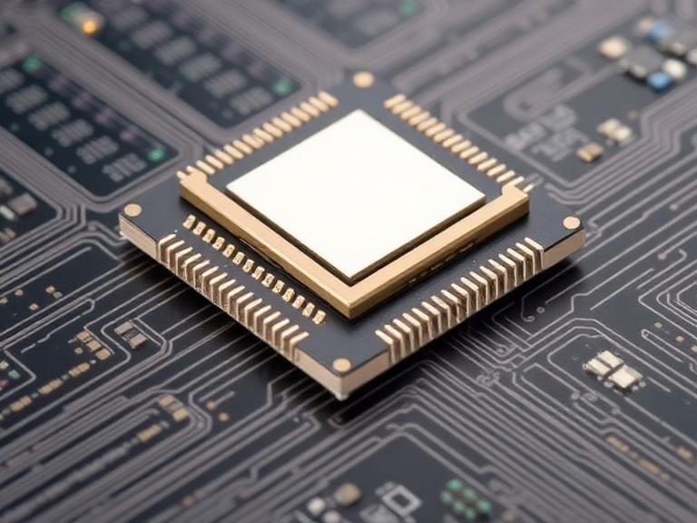
An IMU (Inertial Measurement Unit) measures the specific force and angular rate of the aircraft using accelerometers and gyroscopes. MEMS (Micro-Electro-Mechanical Systems) indicates that these sensors are microscopically etched into silicon chips. A MEMS IMU provides data at blazing fast speeds (400Hz to 1000Hz+), making it perfect for keeping an aircraft stable in turbulent winds. However, an IMU only knows relative motion. Due to microscopic imperfections in the silicon, the data accumulates mathematical errors over time—a phenomenon known as “drift.”
A GNSS fused MEMS IMU is a tightly or loosely coupled hardware and software package that merges these two flawed systems into a single, flawless navigation stream. It utilizes the strengths of one sensor to entirely cancel out the weaknesses of the other.
How It Works: The Mechanics of Sensor Fusion

The magic of a GNSS fused MEMS IMU does not happen in the hardware; it happens in the microprocessor utilizing a mathematical algorithm called the Extended Kalman Filter (EKF). The EKF operates in a continuous, high-speed loop of prediction and correction.
- Prediction Phase: The flight controller takes the high-frequency acceleration and rotation data from the MEMS IMU and uses basic physics kinematics to predict exactly where the drone is and how it is oriented (attitude). This calculation happens hundreds of times per second.
- Measurement Phase: Once every tenth of a second, the GNSS receiver captures a satellite coordinate, providing a definitive, absolute location on Earth.
- Correction Phase (The Fusion): The Kalman Filter compares the IMU’s predicted location against the GNSS’s measured location. Because the EKF knows the statistical noise and error models of both sensors, it calculates a weighted average. It uses the GNSS data to “zero out” the drift that has accumulated in the IMU. Simultaneously, it uses the IMU data to smooth out the noisy, jumping signals inherent to GNSS.
If the aircraft flies into a tunnel or is targeted by a GPS jammer, the GNSS signal drops to zero. The Kalman Filter immediately recognizes the loss of signal integrity and switches to dead reckoning. It relies entirely on the MEMS IMU to navigate safely until satellite lock is re-established. This is why heavy-duty applications, such as operating a vtol cargo drone over populated areas, require tactical-grade MEMS sensors with extremely low drift rates.
Quick Summary Table: Core Components
| Component | Primary Function | Strength | Weakness |
|---|---|---|---|
| GNSS Receiver | Provides absolute global position (Latitude, Longitude, Altitude). | No long-term drift; provides true absolute coordinates. | Low update rate (10Hz); highly vulnerable to spoofing and jamming. |
| MEMS IMU | Measures relative acceleration and angular rotation. | Ultra-fast updates (1000Hz); immune to external signal jamming. | Accumulates mathematical drift over time; cannot find absolute North alone. |
| Kalman Filter (EKF) | The mathematical algorithm fusing the data. | Provides continuous, smooth, high-accuracy trajectory estimation. | Requires massive computational processing power to run in real-time. |
The Operational Benefits in Modern Aviation
From our experience supplying Tier-1 aerospace operators, deploying a GNSS fused MEMS IMU is the difference between a successful mission and a catastrophic hull loss. The primary benefit is absolute operational resilience. When you are flying fixed wing drones beyond visual line of sight (BVLOS), you cannot manually pilot the aircraft out of a jammed sector. The fused architecture allows the aircraft to autonomously execute a dead-reckoning return-to-home procedure safely.
Secondly, the fusion provides phenomenal Size, Weight, Power, and Cost (SWaP-C) advantages. Decades ago, achieving this level of navigational accuracy required massive, mechanical Ring Laser Gyroscopes (RLGs) that weighed 20 kilograms and cost hundreds of thousands of dollars. Today, a tactical-grade MEMS IMU fused with multi-band GNSS weighs less than 100 grams, consumes minimal power, and fits inside the payload bay of a commercial fixed wing drone for photogrammetry.
Limitations and Harsh Realities
We are industry practitioners, which means we must be objective about the limitations of MEMS technology. A GNSS fused MEMS IMU is not magic. In the event of a total, prolonged GNSS denial lasting more than 5 to 10 minutes, the accumulated drift in even the best tactical-grade MEMS IMU will eventually lead to severe positional errors. The aircraft will survive a temporary jamming event, but it cannot navigate across a continent blind.
Furthermore, MEMS sensors are highly susceptible to high-frequency acoustic vibrations and mechanical resonance. If the system is not mounted with highly calibrated vibration dampeners, the engine harmonics will alias into the accelerometer data, completely overwhelming the Kalman Filter and causing erratic flight behavior.
Comparison Table: Navigation Architectures
| Architecture Type | Accuracy During GNSS Jamming | Cost Profile | Best Use Case |
|---|---|---|---|
| Standalone GNSS (No IMU) | Zero (Immediate failure) | Very Low | Basic ground tracking, low-speed marine. |
| Industrial GNSS Fused MEMS IMU | Low (Drifts rapidly within seconds) | Medium | Commercial multirotors, basic mapping. |
| Tactical GNSS Fused MEMS IMU | High (Maintains position for minutes) | High | BVLOS UAVs, cargo logistics, advanced mapping. |
| FOG/RLG INS/GNSS Fusion | Extreme (Maintains position for hours) | Astronomical | Submarines, ICBMs, strategic bombers. |
Who Should Use It
For commercial users and defense operators: Any organization operating high-value assets requires a tactical GNSS fused MEMS IMU. If your operational profile includes deploying military drones in contested electronic warfare environments, or managing bvlos fixed wing uav fleets for critical infrastructure inspection, this technology is mandatory. It is the only way to satisfy aviation authorities that your aircraft possesses a redundant, fail-safe navigation capability in the event of signal loss.
Who Does Not Need It
For beginners and hobbyists: If you are flying a visual-line-of-sight (VLOS) quadcopter for real estate photography on sunny weekends, you do not need to spend $5,000 on a tactical-grade fused navigation system. A standard, commercial off-the-shelf flight controller with basic GNSS will suffice. Heavy-duty sensor fusion is designed to solve complex, high-risk industrial problems, not to hover over a backyard.
Pros and Cons Table
| Pros of GNSS Fused MEMS IMU | Cons of GNSS Fused MEMS IMU |
|---|---|
| Provides unbreakable navigation during temporary GPS jamming/spoofing. | High-end tactical MEMS sensors carry a significant capital cost. |
| Ultra-fast attitude updates for stabilizing aggressive flight maneuvers. | Will still drift during prolonged, continuous GNSS outages. |
| Massive SWaP-C advantages compared to traditional FOG/RLG systems. | Requires intense software engineering (EKF tuning) to function properly. |
| Provides precise timestamping and geo-tagging for photogrammetry payloads. | Highly sensitive to unmitigated engine and airframe vibrations. |
Common Mistakes in Integration
In our testing and consulting with uav manufacturers in china, we routinely see massive engineering failures regarding sensor integration. The most catastrophic mistake is poor vibration isolation. Mounting a highly sensitive MEMS IMU directly to a rigid carbon-fiber airframe housing a combustion engine will result in sensor saturation. The gyros will literally vibrate themselves blind, rendering the sensor fusion useless.
Another major mistake is lever arm offset ignorance. The GNSS antenna is rarely mounted in the exact same physical location as the IMU. If the flight controller software is not programmed with the exact millimeter distance (X, Y, Z axes) between the antenna and the IMU, the Kalman Filter will calculate the aircraft’s position incorrectly during high-bank turns, leading to severe navigation drift.
Buying Considerations for Commercial Operators
When you are evaluating a navigation suite for a professional airframe, ignore the marketing fluff and look directly at the raw specifications. You must prioritize the following metrics:
- Gyro In-Run Bias Instability: Measured in degrees per hour (°/hr). For commercial surveying, demand <10°/hr. For tactical/defense applications, demand <1°/hr.
- Angular Random Walk (ARW): This dictates the white noise floor of the sensor. Lower is better. Demand an ARW of <0.1 °/√hr for stable photogrammetry.
- Coupling Architecture: Ensure the system uses “Tightly Coupled” integration, where raw satellite pseudoranges are fed directly into the EKF, rather than “Loosely Coupled,” which is far less resilient to jamming.
Buying Guide Table
| Specification Requirement | Target Metric | Why It Matters in Professional Operations |
|---|---|---|
| Gyro Bias Instability | < 1.0 °/hr (Tactical Grade) | Determines how long the aircraft can fly straight without GPS before drifting off course. |
| Update Rate | 400Hz to 1000Hz+ | Ensures the flight controller can react to wind gusts and turbulence in milliseconds. |
| Multi-Constellation GNSS | GPS, GLONASS, Galileo, BeiDou | More satellites mean faster locks and better resistance to urban canyon signal blocking. |
| Environmental Rating | IP67 or MIL-STD-810G | Guarantees survival in dust, driving rain, and extreme temperature fluctuations. |
Expert Recommendation from ChinaMoneypro UAV
Our Industry Verdict
At ChinaMoneypro UAV, our roots in defense-grade engineering have taught us that generic, consumer-grade sensors have absolutely no place in a professional airframe. If you are fielding commercial or defense platforms, we categorically recommend utilizing a Tactical-Grade GNSS Fused MEMS IMU featuring a Tightly Coupled Extended Kalman Filter.
The capital expenditure of upgrading from an industrial-grade sensor to a tactical-grade sensor is entirely justified the very first time your aircraft survives an electronic warfare jamming event or a severe multipath environment. Do not risk a $100,000 payload on a $50 consumer IMU. For heavy-duty operations, prioritize multi-constellation GNSS receivers paired with MEMS gyros boasting a bias instability of less than 1°/hr. This ensures your aircraft possesses the definitive dead-reckoning capabilities required to satisfy modern aviation authorities and return home safely.

Frequently Asked Questions (FAQ)
Yes, but only for a limited duration. This procedure is called dead reckoning. A high-quality tactical MEMS IMU can navigate accurately without GNSS for several minutes, relying purely on its internal accelerometers and gyroscopes. However, because mathematical integration errors accumulate exponentially over time, prolonged flights without GNSS updates will eventually result in severe and unrecoverable navigation drift.
In a Loosely Coupled system, the GNSS receiver calculates its own position internally and then feeds that finished coordinate to the IMU’s Kalman Filter. In a Tightly Coupled system, the raw satellite signals (pseudoranges and carrier phases) are fed directly into the core mathematical filter. Tightly coupled systems are vastly superior in professional applications because they can continue to provide mathematical aiding to the IMU even if the drone can only see 2 or 3 satellites in a jammed environment.
GNSS provides excellent absolute location, but it updates far too slowly (typically 5Hz to 10Hz) to keep an aircraft physically balanced in the air. The MEMS IMU provides attitude data (pitch, roll, yaw) and acceleration data at blazing speeds (often 400Hz to 1000Hz). This high-frequency data allows the flight controller to command the motors to react instantly to turbulence, maintaining a stable hover or flight path between the slow GNSS updates.
Authoritative References & Industry Standards
To further explore the engineering mechanics and aviation standards governing sensor fusion, we recommend consulting the following authoritative bodies:
- Federal Aviation Administration (FAA): FAA Unmanned Aircraft Systems (UAS) Guidelines – Details the regulatory requirements for navigation redundancy and BVLOS operational safety standards in commercial airspace.
- Institute of Electrical and Electronics Engineers (IEEE): IEEE Xplore Digital Library – The premier source for peer-reviewed engineering research on Extended Kalman Filtering, MEMS sensor physics, and aerospace navigation algorithms.
- Institute of Navigation (ION): ION Publications & Resources – Offers rigorous technical standards and scientific papers regarding GNSS vulnerability, signal spoofing mitigation, and advanced INS/GNSS tightly coupled architectures.