


In the highly technical realm of unmanned aerial vehicles, flight stability is not achieved by accident. It is the result of complex sensor fusion. While much of the industry’s marketing focuses heavily on advanced GNSS (GPS) modules and high-resolution cameras, commercial operators know that absolute spatial awareness relies on an often-overlooked sensor: the magnetometer. If you do not understand the specific purposes of a magnetometer in drones, you are operating your multi-thousand-dollar equipment with a fundamental vulnerability.
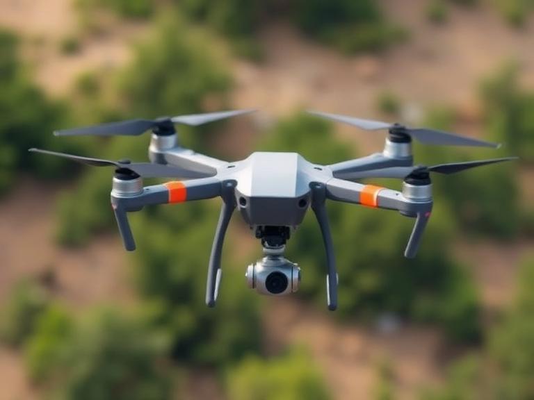
From our experience engineering advanced navigation systems at China Moneypro, relying solely on GPS for directional data is a catastrophic operational error. A GPS can tell you where you are, but when your drone is hovering perfectly still, the GPS has absolutely no idea which way the nose is pointing. That is where the magnetometer steps in. Acting as an advanced 3D digital compass, it reads the earth’s magnetic field to establish absolute heading. In this comprehensive practitioner’s guide, we will break down exactly how this sensor dictates the survival and accuracy of your UAV, evaluate the primary purposes of a magnetometer in drones, and provide commercial judgment on how to optimize your navigation suite for heavy-duty applications.
Quick Answer: The 8 Purposes of a Magnetometer in Drones
The primary purposes of a magnetometer in drones revolve around establishing absolute directional heading (yaw) when positional sensors fall short. The 8 critical functions include: 1) Establishing absolute yaw control during static hover. 2) Enabling safe Beyond Visual Line of Sight (BVLOS) operations. 3) Aligning payloads for precise photogrammetry and mapping. 4) Providing cross-reference data against GNSS spoofing. 5) Compensating for wind drift and crab angles. 6) Ensuring safe and accurate autonomous Return-to-Home (RTH) execution. 7) Stabilizing gimbal and payload orientation. 8) Facilitating dead reckoning in GPS-denied environments. Without a calibrated magnetometer, commercial drones suffer from erratic “toilet-bowling” and catastrophic loss of orientation.
Table of Contents
- What is a Drone Magnetometer?
- How a Magnetometer Works
- The 8 Purposes of a Magnetometer in Drones
- Benefits of High-Precision Magnetometers
- Limitations and Magnetic Interference
- Who Should Use It & Who Does Not Need It
- Common Mistakes in Calibration
- Commercial Buying Considerations
- Essential Comparison Tables
- Expert Recommendation from China Moneypro
- Frequently Asked Questions (FAQ)
What is a Drone Magnetometer?
A drone magnetometer is a solid-state micro-electromechanical system (MEMS) sensor embedded within the flight controller or an external GPS puck. It functions as a highly sensitive digital compass. Unlike traditional needle compasses, a MEMS magnetometer measures the exact strength and direction of magnetic fields across three perpendicular axes (X, Y, and Z). By measuring the Earth’s magnetic field, it provides the drone’s flight controller with a continuous, absolute reference to magnetic North.
How a Magnetometer Works
In most professional situations, drone magnetometers operate using the Hall Effect or Anisotropic Magnetoresistance (AMR). When the Earth’s magnetic field lines pass through the sensor’s internal conductive materials, they alter the electrical resistance or voltage proportionally. The flight controller’s microprocessor reads these voltage changes, runs them through a complex Kalman filter alongside data from the accelerometer and gyroscope (the IMU), and outputs a highly stable yaw calculation. This ensures the drone knows exactly where its nose is pointing, regardless of wind, speed, or satellite connectivity.
The 8 Purposes of a Magnetometer in Drones
1. Establishing Absolute Heading (Yaw Control)
The most fundamental of the purposes of a magnetometer in drones is providing absolute heading. A gyroscope drifts over time, and a GPS requires movement to calculate a vector. When a drone is hovering in place, only the magnetometer can definitively tell the flight controller which direction the drone is facing. This prevents the drone from spinning uncontrollably on its vertical axis.
2. Enabling Beyond Visual Line of Sight (BVLOS) Navigation
When deploying a bvlos fixed wing uav, the pilot cannot see the orientation of the aircraft. The ground control station (GCS) relies entirely on the telemetry downlinked from the drone. The magnetometer ensures that the heading displayed on the pilot’s screen perfectly matches the physical orientation of the aircraft miles away.
3. Assisting Photogrammetry and LiDAR Alignment
Data is useless if it is not oriented correctly. When utilizing a fixed wing drone for photogrammetry, every photograph or LiDAR pulse must be tagged with exact positional and rotational metadata. The magnetometer provides the precise yaw angle at the exact millisecond the shutter fires, allowing post-processing software to stitch orthomosaic maps together without geometric distortion.
4. Cross-Referencing GNSS Data (Spoofing Protection)
In hostile or urban environments, GNSS signals can be jammed or intentionally spoofed. Advanced flight controllers use the magnetometer as a truth-check against GPS data. If the GPS claims the drone is flying North, but the magnetometer proves the nose is pointing East, the flight controller can identify the anomaly and switch to manual or emergency protocols. This is a standard requirement for military drones.
5. Compensating for Wind Drift (Crab Angle)
When crosswinds hit a drone, the aircraft must rotate its nose into the wind to maintain a straight flight path over the ground. The difference between the direction the nose is pointing (heading) and the actual path over the ground (track) is the crab angle. The magnetometer provides the heading, while the GPS provides the track. By calculating the difference, the flight controller automatically compensates for wind shear.
6. Autonomous Return-to-Home (RTH) Execution
If a drone loses connection with the remote controller, it triggers an RTH failsafe. To fly home safely, the drone must rotate its nose toward the home point and accelerate. Without a magnetometer, the drone will likely fly in the wrong direction or enter an erratic, spiraling trajectory known as “toilet-bowling.” The magnetometer guarantees the RTH vector is absolute.
7. Payload and Gimbal Orientation
For platforms carrying advanced optical payloads, such as night vision military drones or broadcast cinema rigs, the gimbal must maintain independent targeting regardless of how the drone body moves. The magnetometer provides the base reference frame so the gimbal’s stabilization algorithms can keep the camera locked onto a specific geographic coordinate.
8. Dead Reckoning in GPS-Denied Environments
If a drone flies under a bridge, into a canyon, or experiences severe solar flares, GNSS locks are lost. In these scenarios, the drone relies on “dead reckoning”—using the IMU and the magnetometer to estimate position based on the last known coordinates, speed, and heading. A calibrated magnetometer drastically reduces yaw drift, allowing the drone to navigate out of the denied environment safely.
Benefits of High-Precision Magnetometers
For commercial users operating a vtol cargo drone, the benefits of investing in high-grade magnetometer hardware are immediate. It ensures perfectly straight flight lines during automated grid missions, drastically reduces battery consumption by eliminating inefficient micro-corrections during hover, and provides the navigational redundancy required by aviation authorities for commercial flight certifications.
Limitations and Magnetic Interference
We must apply practical judgment: magnetometers have a severe Achilles’ heel. They are highly susceptible to electromagnetic interference (EMI) and ferrous metals. If you mount a magnetometer too close to the drone’s high-current ESCs (Electronic Speed Controllers) or battery cables, the electromagnetic field generated by the drone will blind the sensor. Similarly, taking off from a concrete pad loaded with steel rebar or launching near a power substation will corrupt the magnetic baseline, leading to immediate flight instability.
Who Should Use It & Who Does Not Need It
For commercial users and heavy-duty applications: Operators flying mapping missions, pipeline inspections, or deploying any commercial fixed wing uav must utilize dual or redundant magnetometers. Absolute heading accuracy is non-negotiable for commercial safety and data integrity.
Who does not need it: Indoor FPV (First Person View) racing pilots often disable or entirely remove the magnetometer. FPV racers fly strictly manually in acro mode, relying entirely on visual feedback and the gyroscope. A magnetometer in an indoor racing environment is usually flooded with interference from metal building structures and provides no benefit to manual acrobatic flight.
Common Mistakes in Calibration
The most catastrophic mistake we observe in the field is improper calibration. Operators frequently attempt to perform the “compass dance” (rotating the drone on all axes) while wearing a smartwatch, standing next to a car, or having their phone in their pocket. This bakes local magnetic interference directly into the flight controller’s offset tables. You must calibrate the magnetometer in an open, green field, completely free of ferrous metals and personal electronics. Furthermore, ignoring magnetic declination (the difference between magnetic North and true geographic North) in your mission planning software will cause systematic flight path errors.
Commercial Buying Considerations
When sourcing navigation components from top uav manufacturers in china, you must evaluate the integration of the sensor suite. Do not buy standalone magnetometers; buy integrated INS/GNSS systems where the magnetometer, IMU, and GNSS receiver are factory-calibrated to work together within a proprietary Kalman filter. Look for systems that offer automatic magnetic interference rejection and dual-antenna GNSS heading capabilities as a fail-over for the magnetometer in highly ferrous environments.
Essential Comparison Tables
| Function | Primary Operational Benefit | Critical Use Case |
|---|---|---|
| Heading (Yaw) | Establishes direction during static hover. | Aerial photography; maintaining position in wind. |
| BVLOS Navigation | Provides true heading to remote ground stations. | Long-range inspections and cargo delivery. |
| Photogrammetry | Embeds exact rotational metadata into images. | Orthomosaic mapping; LiDAR scanning. |
| GNSS Verification | Detects GPS spoofing and jamming. | Defense; urban infrastructure flights. |
| Wind Correction | Calculates crab angle by comparing heading vs. track. | High-altitude fixed-wing operations. |
| Autonomous RTH | Ensures the drone points home before flying. | Signal loss fail-safes. |
| Gimbal Alignment | Provides base reference for payload stabilization. | Target tracking; surveillance. |
| Dead Reckoning | Limits yaw drift during GPS outages. | Flying under bridges or in dense canyons. |
| Navigation Sensor | How It Determines Heading | Susceptibility to Interference | Best Application Environment |
|---|---|---|---|
| Magnetometer (Digital Compass) | Reads Earth’s magnetic field lines. | Highly susceptible to metal, power lines, and EMI. | General commercial flight in open spaces. |
| Dual-Antenna RTK GNSS | Calculates vector between two fixed antennas. | Immune to magnetic interference; requires clear sky view. | Industrial inspections near steel structures or powerlines. |
| The Pros (Advantages) | The Cons (Disadvantages) |
|---|---|
| Extremely low cost and lightweight (grams). | Requires frequent manual calibration in the field. |
| Provides absolute heading without requiring movement. | Easily corrupted by ferrous metals and internal drone wiring. |
| Draws minimal power, preserving battery life. | Cannot function accurately near high-voltage power lines. |
| Essential for sensor fusion and dead reckoning algorithms. | Subject to natural geographical magnetic anomalies. |
Expert Recommendation from China Moneypro
In most professional situations, a standard hobbyist flight controller with a basic unshielded magnetometer is an unacceptable risk. When you are flying a 20kg cargo drone or a high-value mapping payload, magnetic interference can cause a devastating flyaway. We recommend upgrading your core navigation hardware to a tightly integrated INS (Inertial Navigation System) that utilizes system-level self-calibration to automatically reject magnetic noise.
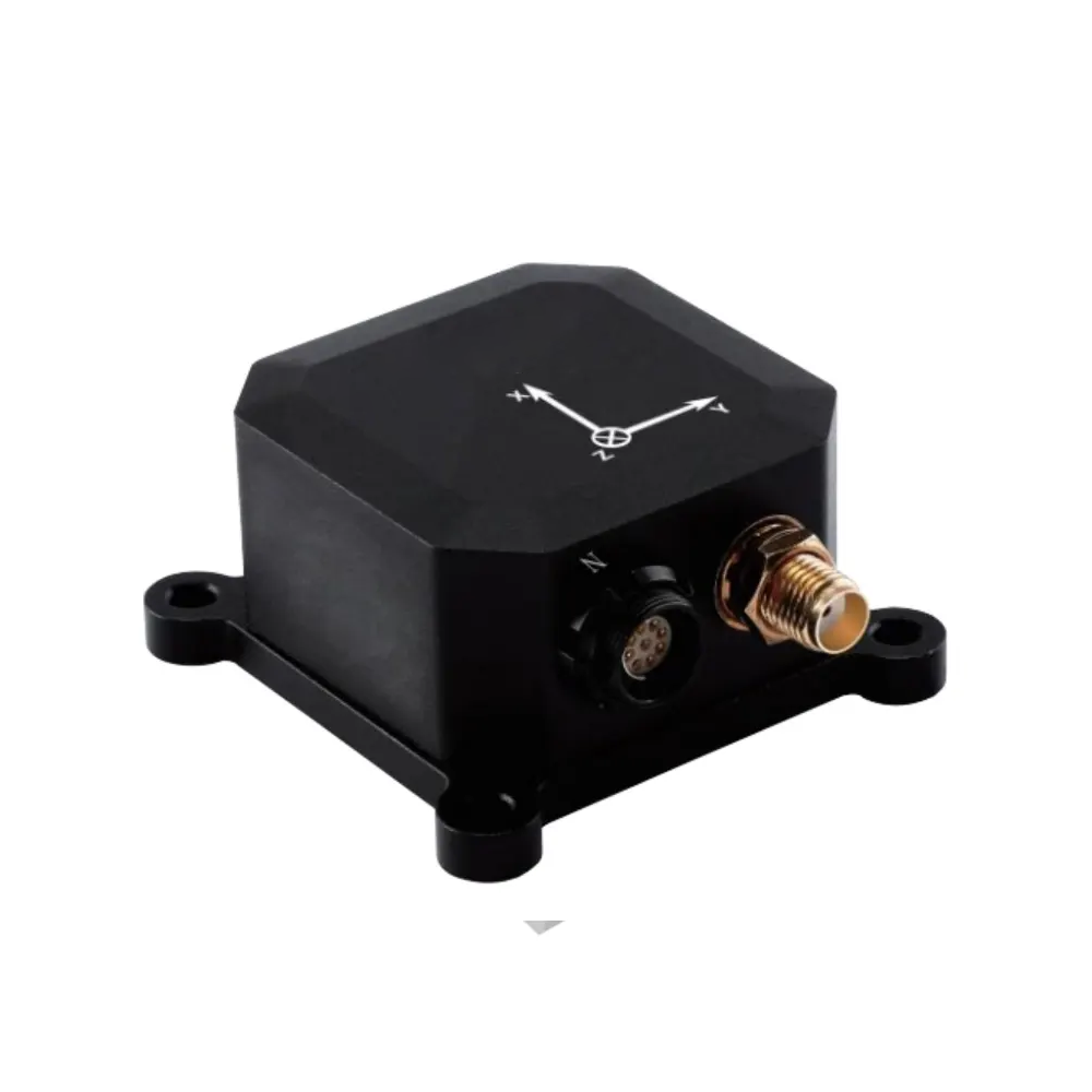
China Moneypro MOPKT-EX8-4N Single-Antenna Integrated Navigation System
Our INS/GNSS navigation system is engineered to overcome severe industry challenges, providing uncompromising heading and attitude data even in magnetically complex environments.
- Integrated MEMS inertial measurement unit (IMU)
- Built-in heavy-duty magnetometer, barometer, and GNSS receiver
- Proprietary INS/GNSS integrated navigation algorithm
- MEMS temperature error compensation technology
- System-level self-calibration and error compensation
- High-precision measurement of angular rate and acceleration
- Accurate heading, attitude, velocity, and position output
- Compatible with SBG Ellipse-N series products
By leveraging an advanced unit like the MOPKT-EX8-4N, commercial operators eliminate the erratic behavior caused by standard compass interference. If you are comparing best uav manufacturers, evaluate them strictly on the robustness of their sensor fusion architecture.
Frequently Asked Questions (FAQ)
Authoritative Industry References
To further understand the critical role of navigation sensors and regulatory compliance in unmanned aviation, we advise consulting the following organizations:
- Federal Aviation Administration (FAA) – The authoritative US government body governing UAV airspace regulations, BVLOS waivers, and performance-based navigation requirements for commercial drone operators.
- Institute of Electrical and Electronics Engineers (IEEE) – The premier academic and professional organization providing peer-reviewed literature on MEMS sensor fusion, Kalman filtering, and magnetometer calibration algorithms.
- RTCA (Radio Technical Commission for Aeronautics) – The leading standards organization developing the Minimum Operational Performance Standards (MOPS) for UAV command, control, and navigation systems.