Home » Unmanned System Products

Showing 595–603 of 1600 results

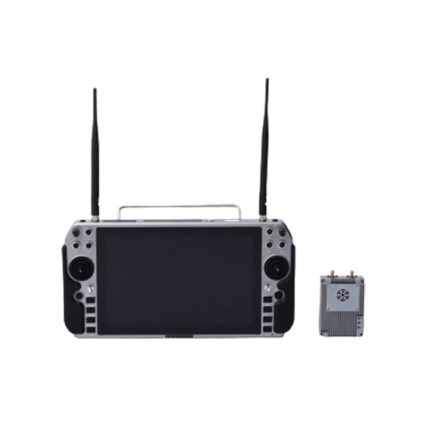
China moneypro MOP P33 High Performance Unmanned Vehicle Map Data Remote Integrated Radio

The MOP1400-P33 is a high-performance, self-developed TDD bidirectional integrated wireless transmission device designed for unmanned vehicles. It incorporates real-time interference detection, automatic frequency selection, adaptive channel rate, automatic retransmission, and power control, significantly enhancing anti-interference performance. Characterized by high reliability, stability, and low latency, the system achieves a ground-to-ground transmission range of 2–3 km under optimal line-of-sight conditions using an omnidirectional antenna.

China Moneypro MOP-100 Unmanned helicopter

Meet the China Moneypro MOP-100—a powerhouse unmanned helicopter built for serious heavy lifting. With a 275cc engine delivering 15.5KW of output, it can haul up to 40 kg of payload and fly for up to four hours. Whether you choose remote control or manual start, this bird handles 93/97 octane gasoline with ease. Ready for high altitudes? It climbs to an impressive 4000m even without a load. Compact yet rugged, with a main rotor spanning over 10 feet, it’s designed to take your operations to new heights.

China moneypro MOP-Remote Control H100

The MOP-Remote Control H100 emerges as a high-performance, user-centric remote control solution tailored for precise operation of unmanned systems (such as UAVs, unmanned ground vehicles, and industrial robots). It integrates a responsive ergonomic design—featuring customizable joysticks, intuitive tactile buttons, and a high-resolution color display—to ensure comfortable, fatigue-free operation during extended missions. Equipped with long-range, anti-interference wireless communication technology, it delivers stable control signals with minimal latency, even in complex environments like urban areas or industrial sites. Additionally, it supports real-time data feedback (e.g., device status, sensor readings) and mission parameter adjustment, while its ruggedized build resists shock, dust, and moisture. Ideal for professional sectors including aerial surveying, industrial inspection, and public safety, the H100 redefines reliable, intuitive remote operation for critical tasks.

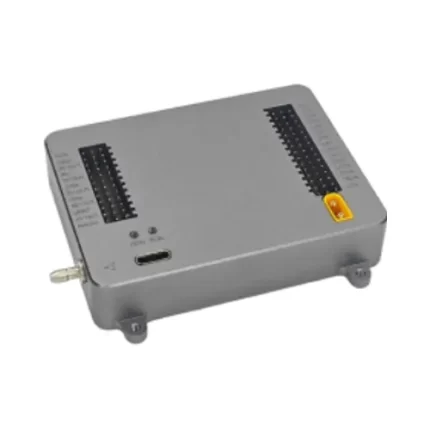
China Moneypro MOPA2 ODM version low-cost loitering munition Flight Controller System

This advanced launch and navigation system supports both ground-based and airborne canister launching. It is engineered to withstand extreme launch stress up to 50G overload at the moment of deployment. The system enables formation flight, satellite-guided precision strike to fixed coordinates, and fully autonomous GPS-denied navigation using inertial guidance technology.

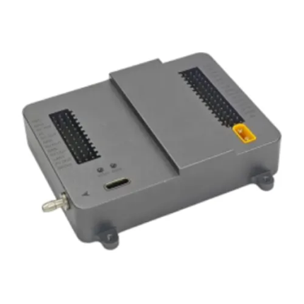
China Moneypro MOPA2PRO ODM version medium-to-large gasoline-powered loitering munition Flight Controller System

This advanced UAV guidance and control system supports rocket-assisted takeoff, gasoline engines, and turbojet engines. It is designed for extreme launch conditions, withstanding up to 50G overload during launch. The system supports formation flight, video seeker and radar seeker integration, and provides high-precision guidance and strike capability against dynamic targets. It also enables fully autonomous navigation using inertial navigation without GPS, ensuring reliable operation in GPS-denied environments.

China Moneypro MOPA2T ODM version guided loitering munition Flight Controller System

This advanced launch and guidance system supports both ground-based and airborne launch tube deployment. It is designed to withstand up to 50G launch acceleration at the moment of deployment. The system enables formation flight, supports both electro-optical (EO) and radar seekers, and provides high-precision guidance against dynamic targets. It also supports fully autonomous navigation using inertial guidance without reliance on GPS, ensuring mission success in contested environments.

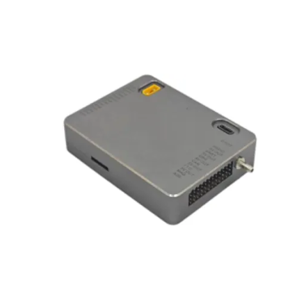
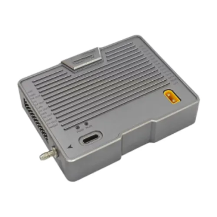
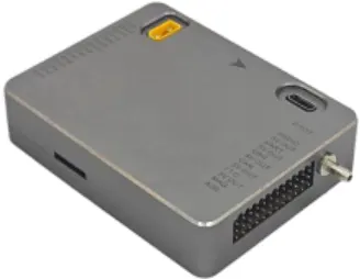
China Moneypro MOPA3 General-Purpose Aerial Survey Flight Controller System

Intelligent Aerial Survey Flight Planning Features Our advanced aerial survey flight planning system is designed for professional mapping, surveying, and photogrammetry applications. It supports multiple data acquisition methods and provides intelligent automation to improve efficiency, accuracy, and flight safety.

China Moneypro MOPA3PRO Patrol Inspection & Reconnaissance Flight Controller System

The Intelligent Multi-Redundancy Sensor System is a high-precision aerial control and tracking solution designed for advanced UAV applications. It integrates a triple-redundant sensing architecture, intelligent target recognition, real-time coordinate calculation, and multi-platform compatibility for gimbals and payload systems.

This system is engineered for demanding industrial environments such as inspection, surveillance, precision delivery, and automated mission execution. By combining stability, accuracy, and intelligent tracking capabilities, it significantly enhances UAV operational efficiency and mission safety.

China Moneypro MOPA3S CAAC Training Examination Flight Controller System

The advanced flight control system for training and examination purposes is a professional-grade solution designed to support UAV mission planning, pilot training, and technical flight control evaluation. It integrates a series of intelligent navigation and calculation tools that significantly enhance operational efficiency, precision, and learning effectiveness.

This system is specifically developed for flight control testing environments and educational simulation scenarios, enabling users to practice real-world UAV mission planning with high accuracy and intuitive controls. It provides a complete set of spatial computation tools, coordinate transformation utilities, and mission editing functions to ensure pilots and trainees can fully understand and master modern UAV navigation principles.

With its intelligent interface and powerful calculation engine, the system allows users to easily switch between coordinate formats, perform advanced mathematical operations, and optimize waypoint navigation routes in real time.