Elevating Security with Low Altitude Radar Technology
n
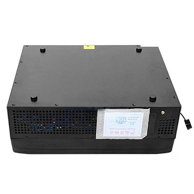
In an era where low-flying drones and unauthorized aerial objects pose growing risks to critical infrastructure, public events, and urban safety, advanced detection systems are no longer a luxury—they are a necessity. The low altitude radar emerges as a cutting-edge solution, purpose-built to strengthen aerial monitoring in complex environments. Operating in the Ku-band, this phased array surveillance system delivers real-time, high-precision tracking of small, low-flying objects, including drones and birds. With comprehensive 360° azimuth coverage and an elevation range of 0° to 30°, it ensures full-range situational awareness. A standout feature, AI identifying birds, dramatically improves target classification by distinguishing natural flyers from potential threats, reducing false alarms and enhancing operational efficiency. Designed for stability and reliability, this compact security radar has a detection range exceeding 3 km for targets with a radar cross-section (RCS) of 0.01 m², making it ideal for airports, military sites, and public gatherings. Its lightweight, modular design integrates seamlessly with communication towers and existing urban infrastructure, offering flexible deployment without compromising performance.
nn
How AI Identifying Birds Transforms Target Classification
n
A core advantage of this low altitude radar lies in its intelligent recognition capability. Traditional radar systems often struggle to differentiate between harmless birds and suspicious low-altitude targets, leading to unnecessary alerts and wasted resources. Here, AI identifying birds leverages advanced algorithms to analyze flight patterns, behavior, and movement characteristics. By accurately distinguishing flying creatures from potential threats—such as unauthorized drones or small aircraft—the system empowers operators to focus on genuine risks. This AI-driven classification not only enhances security but also streamlines monitoring workflows, ensuring that every alert is meaningful. In high-stakes environments like military bases or critical infrastructure sites, this capability provides a decisive edge, reducing response times and improving overall threat assessment.
nn
Phased Array Surveillance: Precision Without Moving Parts
n
Unlike conventional mechanical scanning radars, this system employs phased array surveillance technology, which eliminates the need for physical rotation. This innovation enables faster response times and higher tracking precision, as the radar electronically steers its beam across the sky. The result is a rugged, low-maintenance solution ideal for dynamic environments. With the ability to track over 256 targets simultaneously, the radar maintains a range error of ≤10 meters and an angular error of ≤0.7°, ensuring consistent accuracy. Despite its advanced capabilities, it operates with low power consumption, making it suitable for long-term, continuous deployment. This combination of efficiency and reliability positions the system as a leader in modern surveillance.
nn
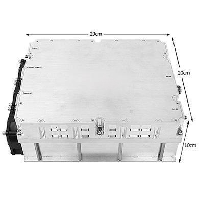
Comprehensive Specifications of the Low Altitude Radar
n
To fully appreciate the technical prowess of this system, it is essential to examine its structured parameters. All specifications are detailed in the table below, which highlights the radar’s capabilities, from operating frequency to installation methods. This data underscores the system’s adaptability for urban and high-security scenarios, where precision and durability are paramount.
nn
| Parameter | Value |
|---|---|
| Operating Frequency | Ku-Band |
| Technical System | 2D phased array three-coordinate |
| Scanning Method | 2D phase scanning |
| Detection Distance | ≥3 km (RCS=0.01 m²) |
| Detection Range | 360°@azimuth, 0°–30°@elevation |
| Detecting Targets | Comprehensive identification of UAV targets or birds through AI, target flight characteristics, etc. |
| Distance Error | ≤10 m@search |
| Azimuth Error | ≤0.7°@search |
| Pitch Error | ≤0.7°@search |
| Target Capacity | ≥256@search |
| Speed Range | 1–80 m/s |
| Data Rate | 3 s@search |
| Machine Weight | 60 kg |
| Dimensions | Single array size: 280 × 355 × 135 mm |
| Information Interface | Ethernet |
| Power Supply | 24 VDC |
| Power Consumption | 1500 W |
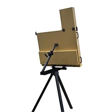
| Installation Method | Can be used for installation on urban towers, communication base stations, poles, and other civil facilities |
nn
Adaptability and Integration for Modern Demands
n
Highly adaptable to dynamic environments, this low altitude radar supports rapid threat assessment through its Ethernet interface, which enables smooth integration with command and control systems for real-time data sharing. Whether deployed at a crowded stadium or a remote military outpost, the radar’s rugged phased array surveillance structure ensures durability and low maintenance under harsh conditions. Backed by AI identifying birds, it provides reliable intelligent protection for urban safety and critical infrastructure. As a highly efficient compact security radar, it combines advanced technology with flexible deployment to meet modern low-altitude security demands, offering peace of mind in an increasingly complex aerial landscape.
nn
Conclusion: Redefining Low-Altitude Security
n
The low altitude radar represents a paradigm shift in aerial monitoring, blending Ku-band precision with AI-driven intelligence. By integrating AI identifying birds, it eliminates guesswork, providing clear differentiation between natural elements and genuine threats. Its phased array technology ensures rapid, accurate tracking without mechanical wear, while the comprehensive specifications—from 360° coverage to robust target capacity—guarantee reliability in the most demanding environments. For airports, military installations, and public venues, this system is not just a tool but a strategic asset. As urban and high-security scenarios evolve, the low altitude radar stands ready to safeguard the skies with unparalleled efficiency and precision.