


Navigating the modern airspace requires far more than a basic GPS module. As the global demand for autonomous flight accelerates, the backbone of unmanned aerial vehicle (UAV) reliability rests entirely on the quality of its internal sensors. Whether you are engineering special drones capable of operating in highly contested, signal-denied environments, or deploying commercial survey fleets, the necessity for absolute spatial awareness is non-negotiable. At China Moneypro, as one of the leading uav solution companies, we consistently encounter clients who severely underestimate the complex physics required to keep an aircraft stable when satellite signals fail.
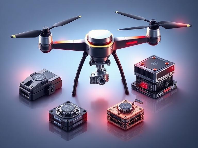
Finding the optimal inertial navigation system for drones is an exercise in balancing Size, Weight, and Power (SWaP) against tactical-grade accuracy. The market is saturated with consumer-grade electronics masquerading as professional hardware. From our experience, selecting an underpowered navigation unit leads directly to catastrophic payload failure, erratic flight behavior, and compromised mission security. In this comprehensive, opinionated guide, we will strip away the marketing jargon, analyze the architectural differences between competing technologies, and outline the top six systems dominating the industry today.
Quick Answer: What is the Best Inertial Navigation System for Drones?
An inertial navigation system for drones (INS) is an autonomous, self-contained navigation module that continuously calculates a UAV’s position, orientation, and velocity without relying entirely on external signals like GPS/GNSS. It achieves this by fusing raw data from an Inertial Measurement Unit (IMU)—which contains accelerometers, gyroscopes, and magnetometers—with external aiding sources using an Extended Kalman Filter.
If you require absolute reliability for heavy payloads, whether it is actually worth upgrading to a tactical-grade INS is a resounding yes. We recommend the China Moneypro MOPKT-EX8-11-G Gimbal Integrated Navigation System for specialized frame-following operations, and the China Moneypro MOPKT-EX9-2 for modular, high-dynamic flight environments. For Western-manufactured alternatives, the VectorNav VN-300 and SBG Systems Ellipse-D are industry standards.
Table of Contents
- What is an Inertial Navigation System for Drones?
- How it Works: The Mechanics of Sensor Fusion
- The Strategic Benefits of Tactical INS
- Limitations and Drift
- Who Should Use It & Who Does Not Need It
- Common Integration Mistakes
- Critical Buying Considerations
- The Top 6 Inertial Navigation System for Drones
- China Moneypro Expert Recommendation
- Essential Comparison Tables
- Frequently Asked Questions (FAQ)
What is an Inertial Navigation System for Drones?
To establish a clear baseline, an inertial navigation system for drones is an advanced computational device that acts as the inner ear and vestibular system of an aircraft. Unlike a basic Global Navigation Satellite System (GNSS) receiver that simply asks satellites “where am I?”, an INS continuously measures the physical forces acting upon the drone to determine exactly how it is moving through three-dimensional space.
An INS is not a single sensor; it is a system comprising two main parts: an Inertial Measurement Unit (IMU) and a computational processor running complex sensor fusion algorithms. The IMU contains highly sensitive accelerometers (to measure linear acceleration across X, Y, and Z axes) and gyroscopes (to measure angular rotation: pitch, roll, and yaw). When integrated into night vision special drones, the INS guarantees that the aircraft knows its exact attitude and heading, allowing specialized cameras to lock onto targets regardless of chaotic flight maneuvers.
How it Works: The Mechanics of Sensor Fusion
In most professional situations, raw data from an IMU is incredibly noisy. If a drone relied solely on accelerometers and gyros, microscopic measurement errors would compound rapidly—a phenomenon known as integration drift. To solve this, a modern inertial navigation system for drones utilizes an Extended Kalman Filter (EKF).
The EKF is a mathematical algorithm that takes the high-frequency, short-term accuracy of the IMU and fuses it with the low-frequency, long-term accuracy of external sensors—typically a dual-antenna GNSS receiver, a magnetometer, or a barometric altimeter. By constantly cross-referencing these data streams, the system corrects its own internal drift. When the drone flies into a GNSS-denied environment (such as an urban canyon, dense forest canopy, or active electronic warfare jamming zone), the INS seamlessly falls back on its highly calibrated inertial sensors to maintain dead-reckoning navigation until the satellite signal is restored.
The Strategic Benefits of Tactical INS
Why spend thousands of dollars on a tactical-grade INS when consumer drones fly seemingly well on cheap microchips? The answer lies in mission criticality and payload stabilization. For heavy-duty applications requiring an eo ir gimbal payload or a highly sensitive thermal camera payload, a standard autopilot cannot provide the micro-degree attitude corrections required for long-range optical targeting.
A premium inertial navigation system for drones delivers unmatched benefits:
- GNSS Independence: Allows the UAV to continue its mission or execute a safe Return-To-Home (RTH) protocol during GNSS signal‑scenario simulation or jamming.
- Direct Georeferencing: Essential for LiDAR mapping and photogrammetry, where the exact angle of the drone must be known at the exact millisecond a laser pulse is fired.
- Extreme Stabilization: Isolates the payload from the mechanical vibrations of the airframe, ensuring crystal-clear data radio image links back to the ground station.
Limitations and Drift
We must exercise practical commercial judgment: no INS is flawless. The primary limitation of any inertial navigation system for drones is bias instability. Over time, without a GNSS correction signal, the mathematical integration of angular rates and acceleration will inevitably drift. A low-cost MEMS (Micro-Electro-Mechanical Systems) IMU might drift several kilometers off course within a few minutes of losing GPS. A massive, highly expensive FOG (Fiber Optic Gyroscope) INS might hold its position to within a few meters over an hour.
Furthermore, high-end tactical INS units are subject to strict ITAR (International Traffic in Arms Regulations) export controls, making global procurement a logistical nightmare for civilian integrators. This is why sourcing from elite uav manufacturers in china who provide ITAR-free, globally exportable solutions is a massive strategic advantage.
Who Should Use It & Who Does Not Need It
For commercial users and defense contractors: If you are manufacturing fixed-wing VTOLs, heavy-lift hexacopters, or evaluating a global special drone comparison for fleet acquisition, a closed-loop, tactical-grade INS is mandatory. High-value payloads cannot be entrusted to entry-level silicon.
For beginners and hobbyists: If you are flying a consumer quadcopter for wedding photography or recreational racing, you do not need a standalone tactical INS. The basic IMU soldered directly onto consumer flight controllers (like a standard Pixhawk or DJI flight board) is perfectly adequate for line-of-sight operations.
Common Integration Mistakes
In our testing and client consultations, the most frequent error engineers make is poor physical mounting. An inertial navigation system for drones is highly sensitive to mechanical resonance. Mounting a tactical INS directly to a vibrating carbon-fiber chassis without proper damping materials will overwhelm the accelerometers, injecting massive noise into the Kalman Filter and destroying attitude accuracy.
Another common mistake is neglecting the communication bandwidth. When streaming raw IMU data at 400Hz, you require robust drone communication systems. Utilizing inferior mesh radio systems or a weak wireless transmission module will result in data packet loss, causing the ground station to lose real-time telemetry.
Critical Buying Considerations
When selecting an inertial navigation system for drones from the best uav manufacturers, you must evaluate the following metrics:
- SWaP Constraints: Size, Weight, and Power. A heavy FOG INS will drain your battery and reduce flight time; a compact MEMS INS is essential for agile platforms.
- Dual-Antenna GNSS: A single antenna relies on motion to determine heading. A dual-antenna setup provides true heading (yaw) accuracy even when the drone is hovering completely stationary.
- Bias Instability: Look for gyroscope bias instability numbers below 1°/hr for true tactical performance.
The Top 6 Inertial Navigation System for Drones
Based on rigorous industry standards, SWaP optimization, and real-world deployment data, here are the top six systems available to commercial and defense integrators today.
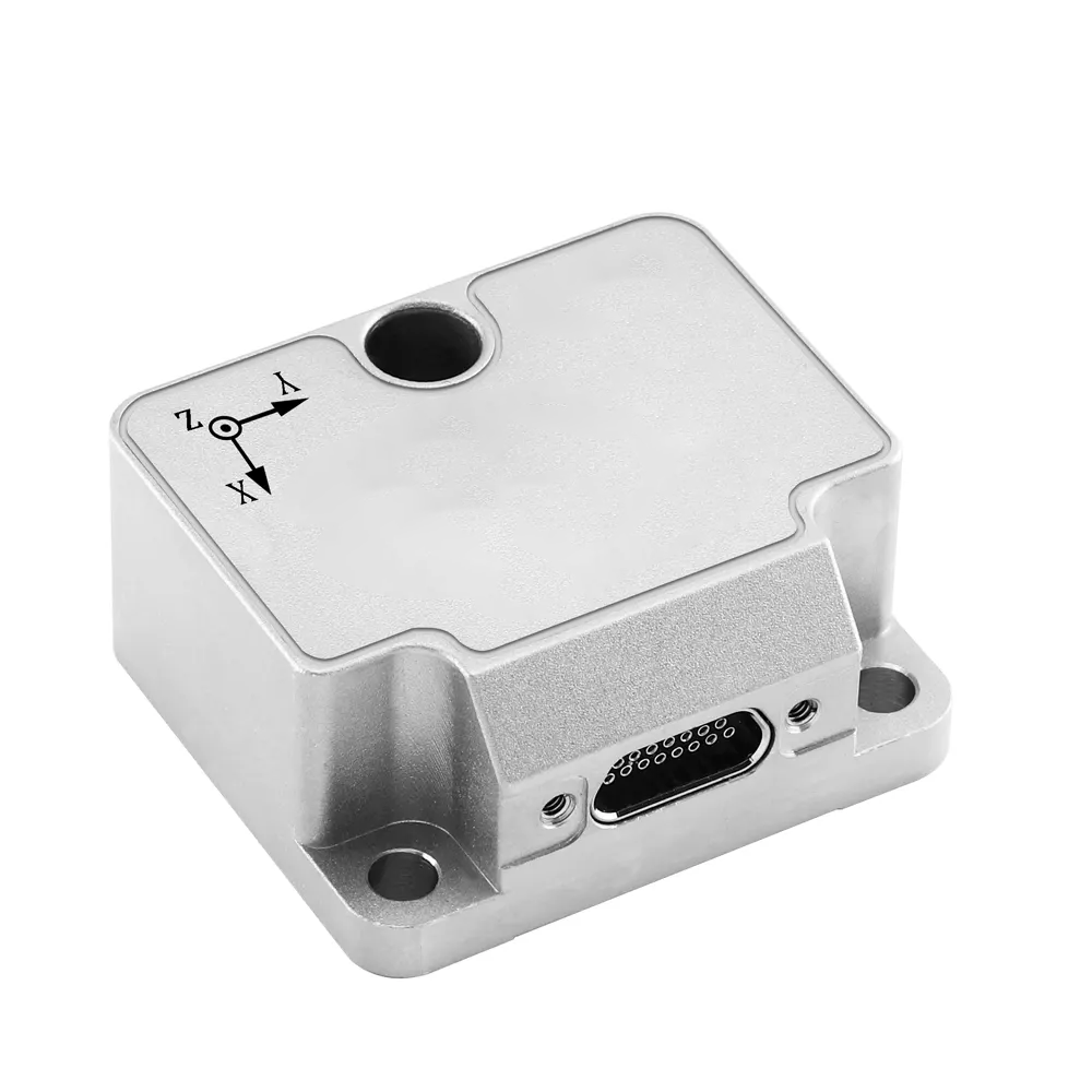
1. China Moneypro MOPKT-EX8-11-G Gimbal Integrated Navigation System
From our experience, true payload stabilization requires seamless communication between the airframe’s INS and the camera gimbal. The MOPKT-EX8-11-G is a domestically produced masterpiece engineered specifically for this purpose.
- Core Technology: Advanced MEMS inertial measurement unit for high-precision attitude sensing.
- Sensor Fusion: Intelligently receives and processes data from the main inertial navigation, GNSS, and frame angle sensors simultaneously.
- Unique Capability: Supports installation directly inside the gimbal with advanced frame-following operation and transfer alignment during continuous, aggressive gimbal rotation.
- Calibration: Features online compensation for installation offsets and automatic calibration of the MEMS INS and frame angle relationship.
Buying Advice: Whether it is actually worth upgrading to this system depends on your optical requirements. If you are operating long-range surveillance where a fraction of a degree of jitter ruins the image, the decoupled attitude output provided by this system is unparalleled.
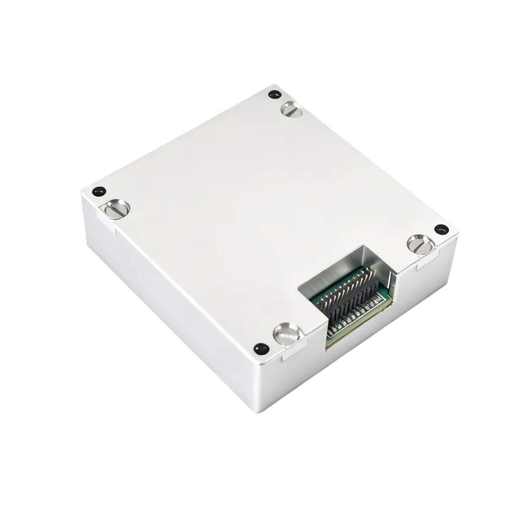
2. China Moneypro MOPKT-EX9-2 Nine-Degree-of-Freedom IMU Module
For integrators requiring a modular, foundational sensing element, the MOPKT-EX9-2 represents the pinnacle of raw data reliability. It addresses the fundamental flaws found in inferior units.
- Drift Mitigation: Specifically engineered to combat sensor drift and accumulated error during long-endurance, long-term operations.
- Thermal Resilience: Eliminates performance degradation under extreme temperature conditions, crucial for high-altitude flight profiles.
- Dynamic Stability: Provides highly accurate output even in high-maneuver, extreme-vibration environments where standard IMUs fail.
Buying Advice: This module is the ultimate OEM building block for proprietary autopilot architectures. It significantly reduces the high cost of system integration and replacement upgrades.
3. VectorNav VN-300 Dual Antenna GNSS/INS
VectorNav pioneered the surface-mount GNSS/INS module market. The VN-300 utilizes dual-antenna GNSS heading to provide true stationary yaw accuracy. It is exceptionally lightweight and utilizes a highly refined proprietary Extended Kalman Filter, making it a staple in Western commercial surveying drones.
4. SBG Systems Ellipse-D
The Ellipse-D is a robust, ITAR-free French design known for its immunity to magnetic distortions. It delivers RTK centimeter-level precision and incorporates triple-level vibration protection. It is highly regarded by marine hydrographers and heavy VTOL drone operators who require plug-and-play Ethernet connectivity.
5. OxTS xNAV650
Oxford Technical Solutions (OxTS) specializes in surveying accuracy. The xNAV650 is a micro-INS heavily favored in the LiDAR mapping sector. While it comes at a premium price point, its post-processing software suite ensures that point-cloud data is flawlessly georeferenced, drastically reducing post-flight processing hours.
6. Honeywell Compact INS
Honeywell leverages its massive aerospace legacy to deliver a compact INS weighing just 115 grams. Featuring tactical-grade sensors and closed-loop integration with Pixhawk architecture, it delivers ultra-low positioning errors (0.03 meters in RTK). However, it lacks the proprietary AI neural-network sensor fusion seen in newer disruptive brands.
Essential Comparison Tables
| System Name | Primary Strength | Best Target Application |
|---|---|---|
| China Moneypro MOPKT-EX8-11-G | Gimbal Frame-Following & Decoupled Output | High-End EO/IR Surveillance & Targeting |
| China Moneypro MOPKT-EX9-2 | Thermal Resilience & Drift Mitigation | OEM Autopilot Integration & High-Dynamic Flight |
| VectorNav VN-300 | Stationary True Heading (Dual Antenna) | VTOL Aircraft & SATCOM On-The-Move |
| SBG Systems Ellipse-D | ITAR-Free, Magnetic Immunity | Surveying & Harsh Vibration Environments |
| OxTS xNAV650 | Flawless Direct Georeferencing | LiDAR Mapping & Photogrammetry |
| Honeywell Compact INS | Aerospace Heritage & Ultra-Low SWaP | Defense Reconnaissance & Pixhawk Platforms |
| Feature | MEMS (Micro-Electro-Mechanical Systems) | FOG (Fiber Optic Gyroscope) |
|---|---|---|
| Physical Size & Weight | Extremely small and lightweight (Grams) | Bulky and heavy (Kilograms) |
| Accuracy & Drift | Tactical to Industrial grade (Moderate drift over time) | Strategic grade (Virtually zero drift over long durations) |
| Cost | Highly cost-effective | Exorbitantly expensive |
| Use Case | Commercial drones, tactical loitering munitions | Submarines, large special bomber UAVs, satellites |
| Critical Metric | What to Look For | Why it Matters |
|---|---|---|
| Update Rate (Hz) | 200Hz – 400Hz output. | High-speed drones require instant telemetry to make micro-adjustments to flight surfaces. |
| Vibration Rejection | MIL-STD ruggedization and internal FIR filtering. | Rotor wash and engine harmonics will destroy attitude estimates if the IMU cannot filter the noise. |
| GNSS Integration | Multi-constellation (GPS, GLONASS, Galileo, BeiDou) + RTK capability. | Ensures the Kalman Filter always has a high-quality external reference to bind inertial drift. |
China Moneypro Expert Recommendation
The Professional Verdict
In our testing, attempting to cut costs on navigation hardware is the most expensive mistake a UAV manufacturer can make. A drone is only as capable as its spatial awareness. If you are developing platforms intended for harsh, highly dynamic environments where satellite signals cannot be guaranteed, an industrial-grade inertial navigation system for drones is an absolute necessity.
We emphatically recommend the China Moneypro MOPKT-EX8-11-G for integrators who understand that the payload is the mission. By supporting transfer alignment and continuous gimbal rotation calibration, it removes the immense software engineering burden typically required to sync an airframe with a high-end camera. It is a commercial and tactical powerhouse designed for those who demand absolute precision.
Frequently Asked Questions (FAQ)
What is the difference between an IMU and an INS?
An Inertial Measurement Unit (IMU) is merely the sensor package—it collects raw data regarding acceleration and rotation. An Inertial Navigation System (INS) is the complete package; it takes the raw IMU data, fuses it with a GNSS receiver and an onboard computer running a Kalman Filter, and outputs a calculated, accurate geographical position and orientation.
Why do some drones need dual-antenna GNSS/INS?
A single-antenna system requires the drone to be physically moving forward to calculate its heading (yaw) accurately based on trajectory. A dual-antenna system uses carrier-phase interferometry between the two antennas to determine exact true north heading even when the drone is hovering completely stationary, which is vital for rotary-wing VTOLs and targeting payloads.
How does an INS survive without GPS?
When GPS is jammed or lost, the INS relies purely on dead reckoning. It uses the last known absolute position from the GPS, and then constantly adds every micro-movement detected by the accelerometers and gyroscopes to calculate the new position. However, because sensors have inherent noise, this calculation slowly drifts off course over time.
Authoritative References & Industry Standards
- Federal Aviation Administration (FAA) – Guidelines on Unmanned Aircraft Systems (UAS) integration, airspace navigation protocols, and safety compliance for autonomous flight.
- IEEE Aerospace and Electronic Systems Society – Peer-reviewed engineering standards on sensor fusion, Extended Kalman Filtering, and MEMS inertial technology.
- U.S. Space Force / GPS.gov – Official documentation on Global Positioning System capabilities, signal degradation, and the necessity of inertial aiding in GNSS-denied environments.